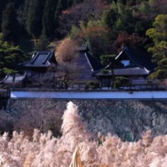
Daiun-ji Temple's Susuki-filled Pond
この戸倉上山田温泉から車で約20分、自転車で約50分で千曲市八幡地区に大雲寺と言う歴史的なお寺さんがある。お城を思わせるお寺が1581年に建てられたそうです。立派な桜の木もあって、花は4月に見事。お寺の東側に溜まり池があって、蓮の花で有名である。(花の時期は7月末~8月)
大雲寺の前はその蓮の池、裏周りは一重山と霊靜山。その全てが「大雲寺自然探勝公園」と指定されいている。今回は子供達を連れて、その公園の約1時間のハイキングコースを歩いた。
時期は11月なので池の蓮は咲いていなかったけど、すすきがふわふわとなっていて、綺麗でした。池の北側にちょっとしたボードウォークがあって、薄の中に入れると言う不思議な感じだった。
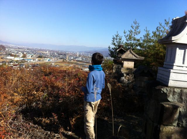
まずは森の中に入って490mの霊靜山とその手前の山を登った。両方の頂上から善光寺平が見えて、意外に綺麗な景色だった。霊靜山の天辺に石仏・石神郡がある。怖い鬼や剽軽な猫神、石像も手彫り木造も、さまざまな石仏・神がある。「わらべじぞう」って書いてある割と新しいのもあって、子供達と一緒に楽しく見ていました。
霊靜山から降りて、今度は5歳の美咲ちゃん先頭で520mの一重山を登った。頂上にあずまやがあって、パノラマの景色を楽しめる。落ち葉の中を歩きながら、またお寺まで下りた。
池と森の小山の自然を歩いて、剽軽のお地蔵さんを楽しんで、良い思い出となった親子ハイキング。
About 20 minutes by car or 50 minutes by bicycle, in Chikuma City's Yawata district is Daiun-ji, a very historical temple. The imposing castle-like building was constructed in 1581. Massive cherry trees add a soft, graceful touch with their blossoms in April. On the east side is a moat, err, pond-like reservoir that in late July and August explodes in color with beautiful lotus flowers. On its other three sides the temple is surrounded by Mt. Hitoe and Mt. Reijou that tower 250-meters over the temple grounds.
Daiun-ji and its pond and surrounding mountains have been designated the Daiun-ji Nature Viewing Park. The other day, I took our kids for a hike on the park's approximately 1-hour trail.
Being that it was November, the pond's lotus flowers weren't in bloom but the susuki (Japanese pampas grass) were in full fluffy form. On the north side of the pond is a boardwalk that extends into the heart of the pampas grass, for a fuzzy-wuzzy feeling.
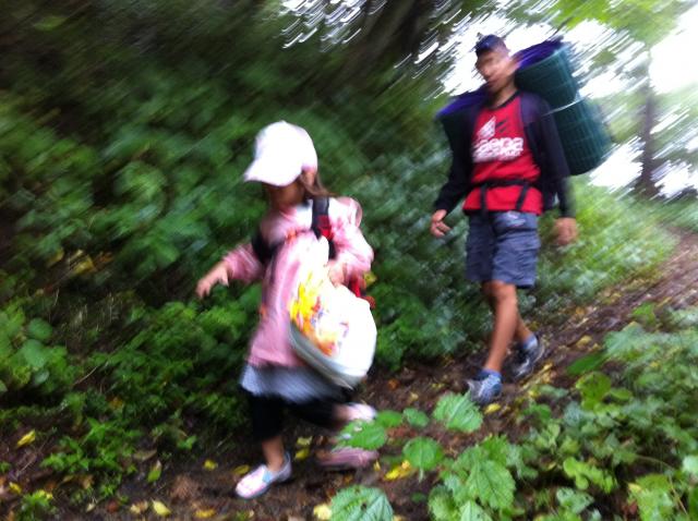
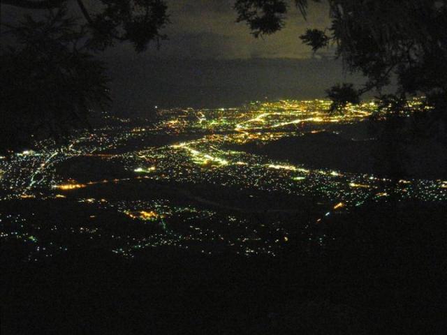
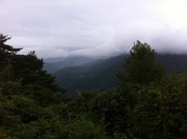
From there, we walked a bit north and entered the forest, climbing up to 490m Mt. Reijou and its foothill. Both peaks offer surprisingly outstanding views of the Chikuma River valley and the Zenkoji Basin. And Mt. Reijou is crowned by, well, a crown of stone and wooden statues. It's a curious mix of Buddhist and Shinto figures -- a scary Oni (ogre), a funky cat god there. The kids and I enjoyed looking at the often-times comical expressions on their faces.
After descending from Reijou-san, our 5-year old daughter Misaki led the way up to the top of 520-meter high Mt. Hitoe. The peak has a wooden gazebo that serves as a lookout point. From there, we waded through the fallen leaves and descended back down to the temple.
View-filled hike with a colorful pond, thick forest, and small mountains topped by funky statuettes. The Daiun-ji Nature Viewing Park makes for a perfect family outing.
大雲寺Daiun-ji Temple
霊靜山の石仏・神 Mt. Reijou Statues
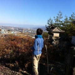
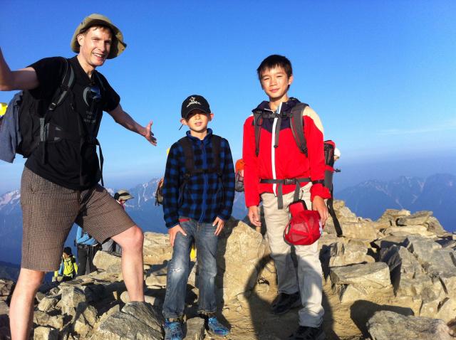
Andy enjoying one of the many viewpoints along the Daiun-ji Hiking Trail
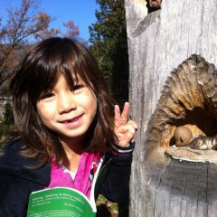
Misaki and one of the Mt. Reijou statues
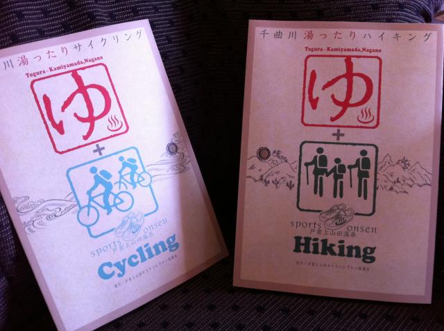
今回の大雲寺自然探勝公園コースのガイドが友人Peter Ninnesさんの千曲市ガイド本でした。Peterさんはコースがどうやってわかったか知らないけど、この本がなっきゃ分からなかった。
Our guide for the Daiun-ji Temple Nature Viewing Park hiking course was my buddy Peter Ninnes' book "Hiking, Walking and Biking Nagano: 20 Nature, History and Culture Tours in Chikuma City". I don't know how Peter found the trails when he researched the book, but it was an absolute necessity in trying to decipher the path around Daiun-ji.
Hiking, Walking and Biking Nagano: 20 Nature, History and Culture Tours in Chikuma City
By Peter Ninnes