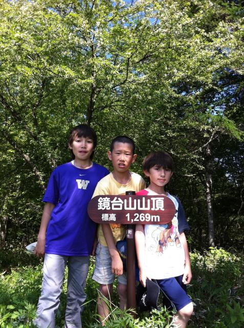
Our 2 sons and friend Rintaro at Kyoudai-san's summit
戸倉上山田温泉の周辺の山の一つ、鏡台山を登ってみました。姨捨の「田毎の月」の伝説に出てくる山: 満月が鏡台山の上から出てくれば、姨捨の棚田に田んぼ毎に映る。姨捨から鏡台山は何百回見ていますが、今日は初めて姨捨山を鏡台山から見ました。
息子たちは学校が休みだったので、天気もパーフェクトだったし、せっかくだったからお出かけしました。
登山口までの道は最近の雨から土崩れ通行止めの看板が出ていました。でも、他の車も走ってそうでしたので冒険で行ってみました。所々の地面に石が落ちていましたが、注意しながら問題なく行けました。
登り口の看板に「頂上まで120分」って書いてあったが、途中で何回も休みながら小学校3年生の子供でも1時間半で頂上に着いた。最初の10分は松林の中の上り坂、次の10分は林道を登ってそして残りはまたちゃんとしたハイキングコースでした。松林、笹の迷路、山つつじやシラカバなど、さまざまな環境や植物で登って面白かった。
北峰に先に辿り着くので、「その昔、周辺の小学校がここで運動会をやっていた」と言う説明看板と何故か象さんの鈴。もう10分頑張れば、本来の頂上に着くので、千曲川と善光寺平の景色が目の前に広がる。ここも、鈴がありました。一生懸命鳴らしたが、山の天辺だから下まで音はきっと届かないだろう。でも、良い思い出。
実は、鏡台山を登った裏目的もあった。今週に私が手伝って作った戸倉上山田温泉・千曲市のハイキング・サイクリングマップが出来上がる。鏡台山も紹介されているので、一度は自分の足で登ってみたかった。登ってみたら、納得しました。町の皆様も、観光客もこのマップを使って、登ってみたら絶対に喜んで頂けると思いました。
最後ですが、車に戻って、倉科へ下がる途中で「縄文の清水」と言う湧水があります。ハイキングで汗をかいてから、その水が最高に美味しかった。顔や頭にもかけて、一気にクールダウンしました。お勧めです。
One of the mountains that overlooks Togura Kamiyamada is Kyoudai-san. A 'kyoudai' is a traditional Japanese interior furnishing. It's basically a low vanity table with a mirror attached. Most of our guest rooms here at Kamesei Ryokan have one and our female guests often sit in front of it, lay out their cosmetics on the top, and apply their makeup using the mirror. So, why a mountain named after a piece of furniture? It is a reference to the Obasute 'tagoto no tsuki' legend about the moon reflecting in the individual rice paddies. When the moon raises over Kyoudai-san mountain, it is in the perfect position and angle to reflect in Obasute terraced rice fields.
Anyways, I've seen Kyoudai-san from Obasute hundreds of times, but today I hiked up Kyoudai-san and saw Obasute from the summit for the first time. Our sons were off from school, so I piled them in the car and headed over to the trailhead. The road had a barrier blocking it with a sign about being washed out. But other cars had apparently been travelling on it, so we gave it a go. There were rocks and debris in places washed down over the road by the recent rain, but using a bit of caution it was all passable.
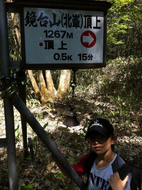
The sign at the trailhead says 120 minutes to the top. Even with stopping liberally for breaks and a 3rd grader in tow, we made it in just 1-1/2 hours. The first 10 minutes climbs up a slope through a pine tree forest, then you follow a forest road for the next 10 minutes. The rest is back to a true hiking path, and goes through more pine forests, 'sasa' bamboo grass groves, passing birch trees and wild azaleas -- a real variety of terrain and flora.
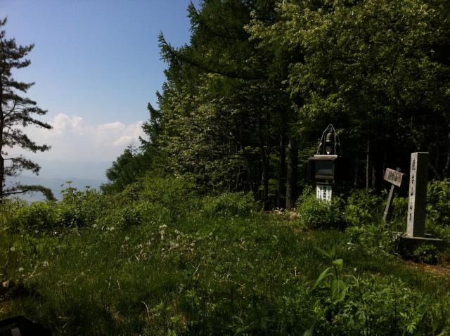
You reach the north peak first, where there is a sign saying the local schools used to use the opening there for athletic competitions (seems like a long haul to go just to play tug-of-war), and there was an elephant-shaped bell (don't ask). From there, you push on another 10 minutes and finally reach the main peak with its outstanding view of the Chikuma River valley down below. There is a bell there, too, and I rang it as hard as I could. But since it's at the top of a mountain, I doubt anyone below could hear.
To be honest, I had an ulterior motive for climbing Kyoudai-san. This week, a hiking / climbing map of Togura Kamiyada Onsen and Chikuma City that I've been working on will be released. Kyoudai-san is one of the mountains featured, and I wanted to hike it once with my own feet. After doing so, I am confident that locals and visitors alike will be able to use the map and enjoy the hike.
One last comment -- after reaching the car and starting to drive back down, there is a natural spring. We stopped for a drink and to splash water on our faces and heads. Instant chill satisfaction! I highly recommend it!
The main peak
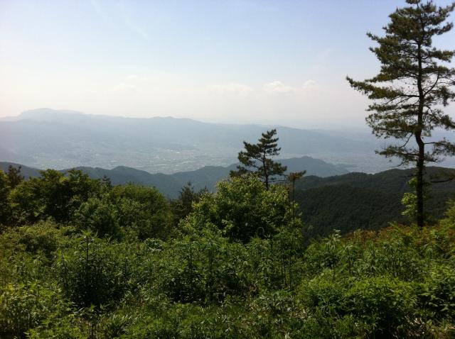
View from the peak

Andy filling out the book
north peak
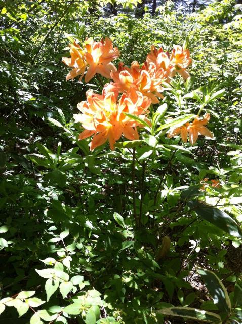
wild azaleas