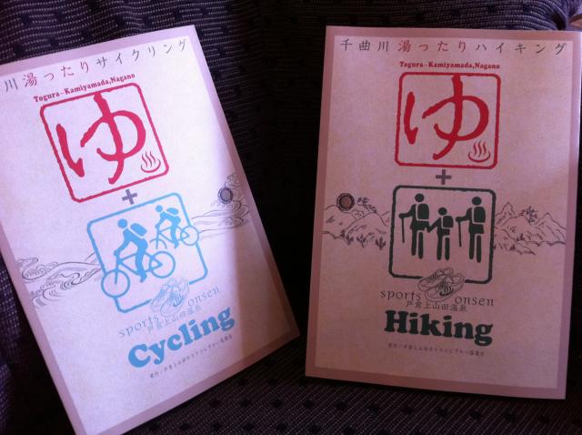
ダブル表紙 … 良いでしょう!
この春に作成作業をずっとしていた戸倉上山田温泉ハイキング・サイクリングマップはやっとできました。出来立てホイホイでこれから色んな所に配って行きます。
私にとっては戸倉上山田温泉の魅力の1つは真ん中に流れる千曲川と周辺の山々です。そして千曲沿いのサイクリング道路で川の風情をたっぷり楽しめるし、山は登ればその自然の良さが分かります。この地図を利用して、より多くの人達にその川と山の魅力を体験して頂きたいと思っております。
なおかつ、この夏は特に電気を食う冷房を使わない戦略が大事です。そこで、この地図が役に立つと思います。自転車ツーリングで千曲川沿いの涼しいを楽しめる。山の天辺での温度は下より約5℃ぐらい低いので、山登りでその気持ち良さを感じれます。
サイクリングやハイキングで汗をかけてから、戸倉上山田温泉に戻って、お風呂に入ったらまた最高に気持ちいいです。
その様に、この新しいマップが役に立つように望んでいます。私がマップ作成者の宮坂さんと共にに、千曲サイクリングクラブや里山みどり守る会と紹介するルートを話し合った上で、自らそれぞれのサイクリングとハイキングコースに足を運んで、確認しました。デザインも工夫して、「こんなに楽しいよ!」「こんな所が見れるよ」と分かるように写真を付けて、なかなか良いマップが出来ました。マップ希望者はどうぞ、声をかけてください。
This spring, I've been working on a Hiking / Cycling Map for our onsen town, Togura Kamiyamada. It is finally finished and I am so excited to finally get the fresh-off-the-presses new map!
One of the things I love about Togura Kamiyamada is the grand Chikuma River flowing through the middle and the lush green mountains surrounding the town. I hope this new map will encourage lots of people to get out and enjoy cycling along the picturesque Chikuma River using cycling path as well as strap on their hiking boots and experience the natural grandeur of our local mountains.
With the concern for lack of electricity production this summer, everyone will be thinking about ways to not use airconditioning. Here again, our new hiking / cycling map should come in handy. Riding along the Chikuma River Cycling Road is a great way to enjoy the river's refreshing breeze. And if you climb to the top of one of our nearby mountains, you'll be pleased to find the temperature a good 5 degrees cooler than down below.
Plus, after getting all sweaty from cycling or hiking, you can come back to Togura Kamiyamada Onsen and enjoy a rejuvenating soak in an onsen bath.
That's how I'm hoping our new map can be useful. The map producer, Miyasaka-san, and I discussed which routes are best with both the Chikuma Cycling Club (for cycling) and the Sato-Yama Midori Mamoru Kai (for hiking), and then rode or hiked each and every course ourselves to verify the details. We added a lot of clever design elements as well as a thorough selection of pictures giving a useful image of the courses and the scenery that can be enjoyed along the way. A pretty darn good map if I do say so myself. If you would like a copy for yourself, just let me know!
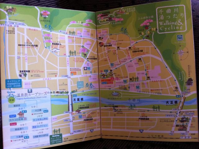
開くと、温泉の中のお勧めコース
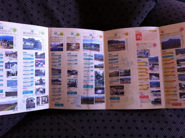
更に開くと、サイクリングコースの明細
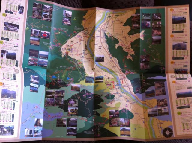
最後に開くと、サイクリングとハイキングコースが載っている千曲市全体の地図+ハイキングコースの明細