Early Winter Hike of Kamuriki-Mtn.
今日は亀清旅館の玄関を出て、上山田温泉の本通りを通って、歩いて約10分の所の佐良志奈神社から登って、3時間後は冠着山の頂上に着きました。
途中は上からの千曲市や善光寺平の展望台、楢とかブナの林や笹・アカマツの森など次から次へ様々の環境を通って、鹿や熊の糞や狼の足跡を見たり、遠くの北信5つの山や完全に白くなっている北アルプスの景色を見ながら、場所によってトラロープを使って急な斜面を登ったり、
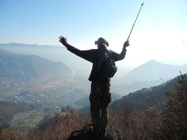
とにかく一生に忘れられない冒険になりました。
宿の玄関から出てこんな近くにこんなに気持ちいいハイクがあるとの事はとにかく凄いです。
以前は戸倉上山田・千曲市の周辺の山登りの地図を作りました。その時に千曲市の代表の山、高さ1252mの冠着山(aka姨捨山)の登山道も載せました。その時に紹介したルートは北側の900mの坊城平からの登って約50分のでした。
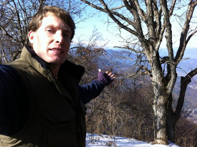
しかし、標高の約370mの佐良志奈神社からも、尾根をずっと通れば、同じ頂上にたどり着くという噂を聞いていました。今日は友達のPeterさんとその3.8km、標高差約880mを登りました。時期は時期で上の方に雪が少しありましたが、頂上に無事に着きました。登り口から3時間20分ぐらいかかりました。
これだけのちゃんとした山のハイキングとこれだけの素晴らしい眺め、自然と触れ合える場所があって、嬉しいです。
そして降りてきたらもちろん、亀清のお風呂に入りました。
良いハイキング、良いお湯、最高の一日でした。
Today, I walked out of Kamesei's front entrance, went down Kamiyamada Onsen's main street about 10 minutes walk to Sarashina Shrine. From there, a road goes up the side of Hachioji-yama and at a saddle point starts a hiking trail to the top of Kamuriki Mountain. There commenced a 3 hour, very strenuous hike to the peak.
On the way up, my buddy and I were rewarded with views of the Chikuma River valley and the Zenkoji Plain down below, as well as of the far off Northern Nagano 5 Peaks and the snow covered Northern Alps. The trail passes a wide variety of microcosms, from oak and beech tree woods to fields of bamboo grass spotted with wrangled, weathered red pines. We saw all kinds of signs of wildlife, such as bear and deer scat as well as fox foot prints. Part of the hike included fixed rope ascents and scrabbles over gravel fields.
All in all, an amazingly enjoyable hike. And all easily accessible from our front door!
I recently helped put together a hiking / cycling map for Togura Kamiyamada Onsen / Chikuma City and surrounds. For our city's signature mountain, this 1252-meter Kamuriki-yama, we showcased the short, 50 minute hike from 900-meter Bojo-daira. However, I had heard that the peak could also be reached by walking along the ridge all the way from Sarashina Shrine.
Hence today, my buddy Peter and I set out from the trailhead, and 3.8 kilometers and 880 meters of elevation gain later, we got to the peak.
All from our inn's doorway. And of course, after the hike, we came back and soaked in our inn's onsen bath.
Awesome hike, awesome onsen -- an awesome day!
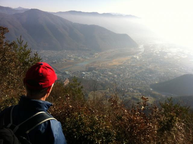
Viewpoint over the Chikuma River Valley
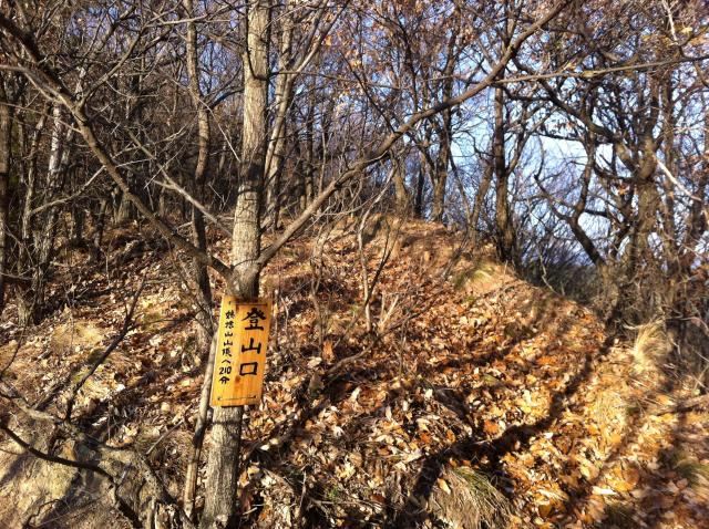
Trailhead above Sarashina Shrine
Better view of the viewpoint
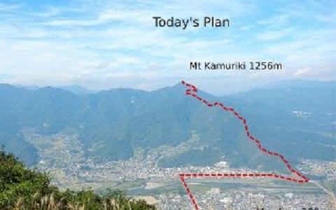
Our course. Start = 370m (Courtesy of Peter-san)