東信の代表の登山ループ: 根子岳と四阿山 Epic Eastern Nagano Loop Hike: Nekodake and Mt. Azumaya

2023.04.24: 季節 Seasons, 長野に来る理由 Reasons to Come to Nagano, 信州の山 Nagano’s Mountains

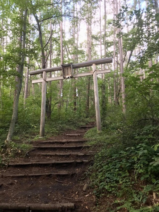
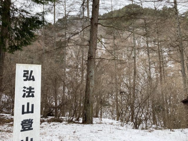
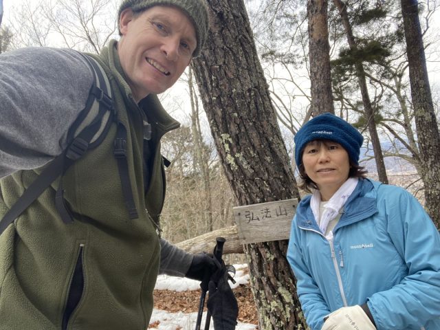
百名山である2,354mの四阿山と花百名山である2,207mの根子岳は菅平牧場から約7時間の登山ループで繋がれている。Mt. Azumaya (one of Japan’s 100 Famous Mountains) and Neko-dake (a Top 100 Wildflower Mountain) can both be climbed via a 7-hour loop hike from the Sugadaira Pasture.

菅平から見る根子岳(左)と四阿山 Nekodake (left) and Mt. Azumaya from Sugadaira

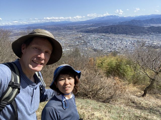
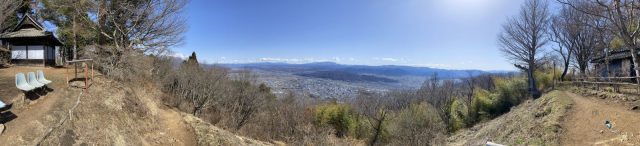
以前は四阿山も根子岳も個別で登った。4月20日にその二つの山を繋ぐ2.5kmの道も歩けて、ループ出来ました。特に四阿山に部分的に雪が残っていて、アイゼンが必須でした。四阿山の頂上からの360°パノラマが特に印象的。煙を出している浅間山→湯の丸と烏帽子とその後ろに蓼科→美ヶ原とその奥に北アルプス→白馬連峰→戸隠と高妻と黒姫と妙高→白根山。四阿山のコースは笹と白樺から始まり、途中からは松林、様々な景色が楽しい。根子岳コースの下の分は牧場沿いで菅平高原スキー場を眺めながら快適に歩ける。戸倉上山田温泉からアクセスは楽(高速で牧場まで41km, 52分)朝9時に出たが日帰りは可能。

We’d climbed both peaks individually before but on 20-April we managed to do the 2.5km course to Nekodake after summiting Mt. Azumaya for an enjoyable loop hike. The 360-degree view from the top of Azumaya was particularly impressive, and the trail offers a great variety of scenery, from bamboo grass with birch trees to pine forests. Nekodake’s course runs along a cow pasture at the bottom for expansive views of the Sugadaira Highlands and ski areas.

牧場の駐車場から北アルプスの眺め まだ冬季だったから簡易トイレ敷かなかったけど、4月21日は公式の開山だそうで、それから常設トイレと売店が開くそうです。 View of the Northern Japanese Alps from the Sugadaira Pasture parking lot.  The regular toilet and gift shop probably open with the official start of the climbing season on 21-April, but there was a porta-potty.

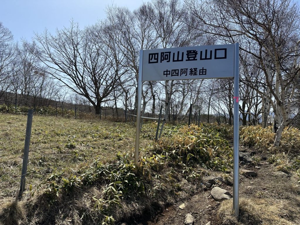
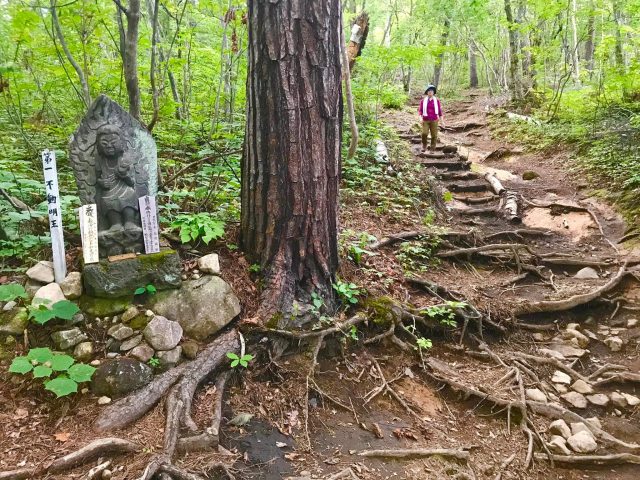
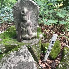
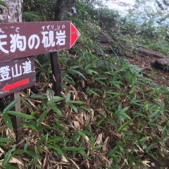
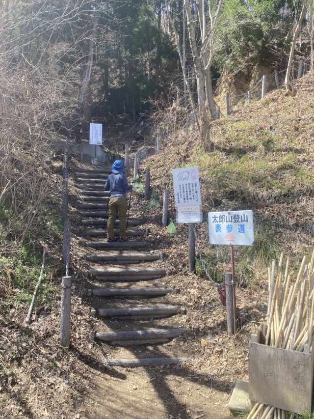
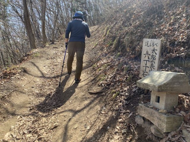
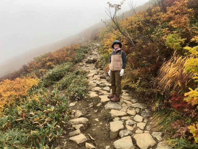
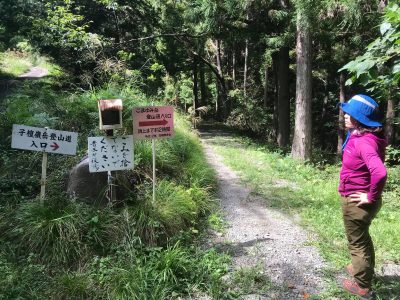
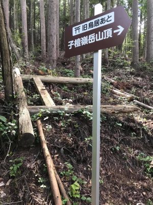
Mt. Azumaya trailhead

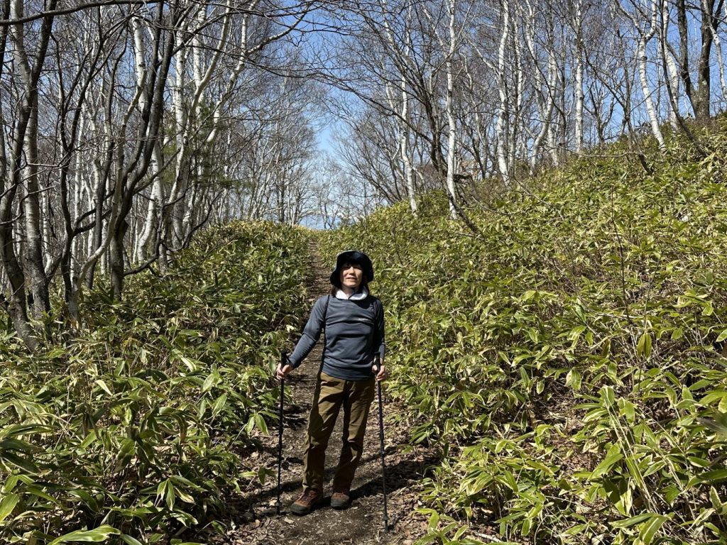
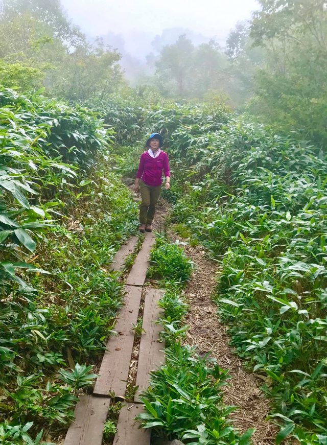
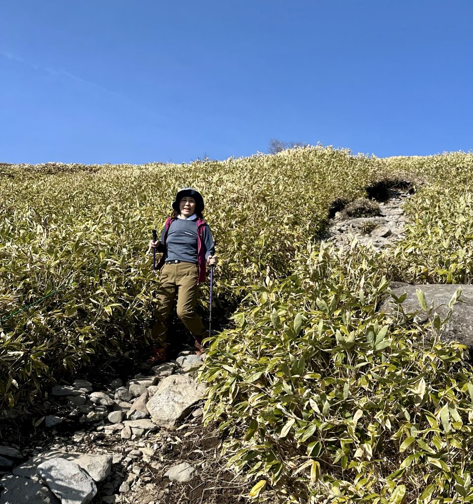
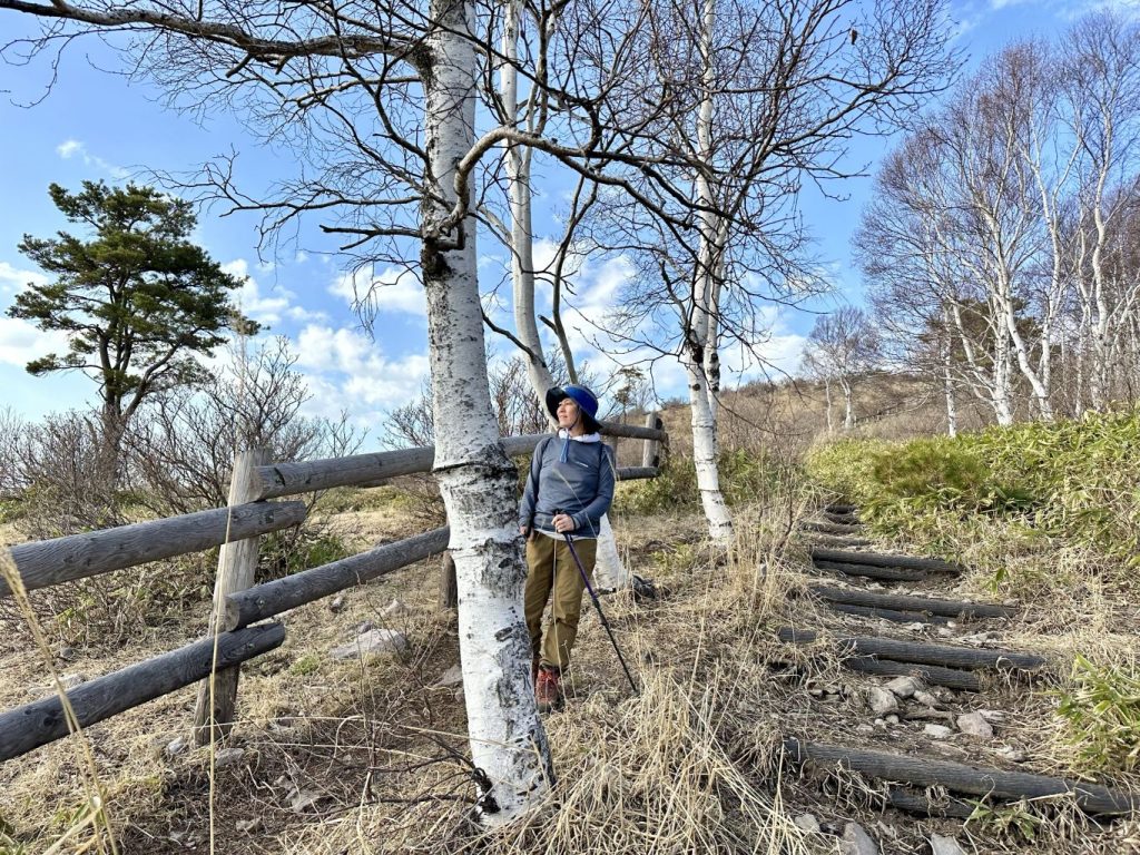
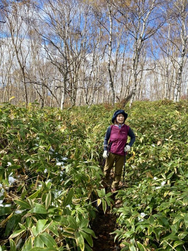
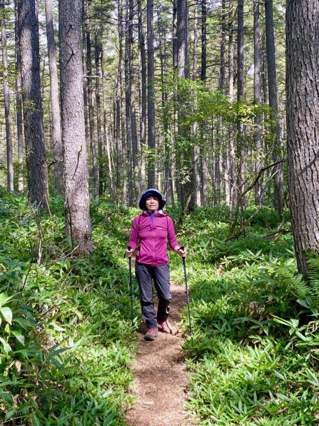
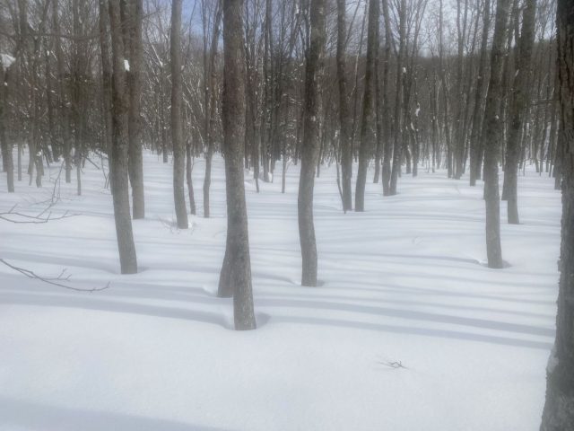
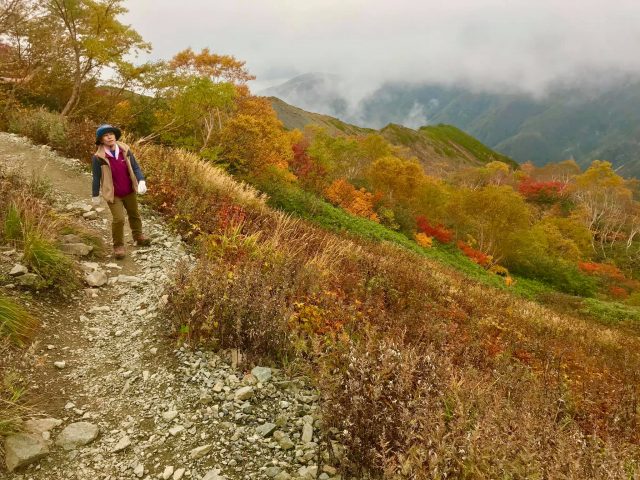
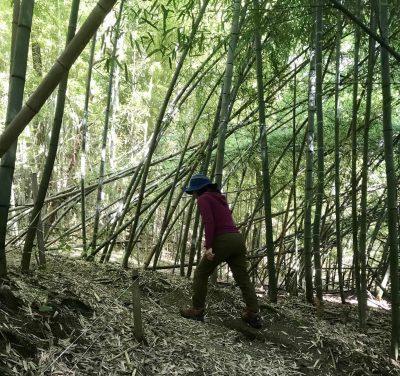
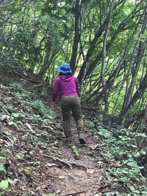
前半は笹と白樺 The trail starts through "sasa" (bamboo grass) and birch trees.

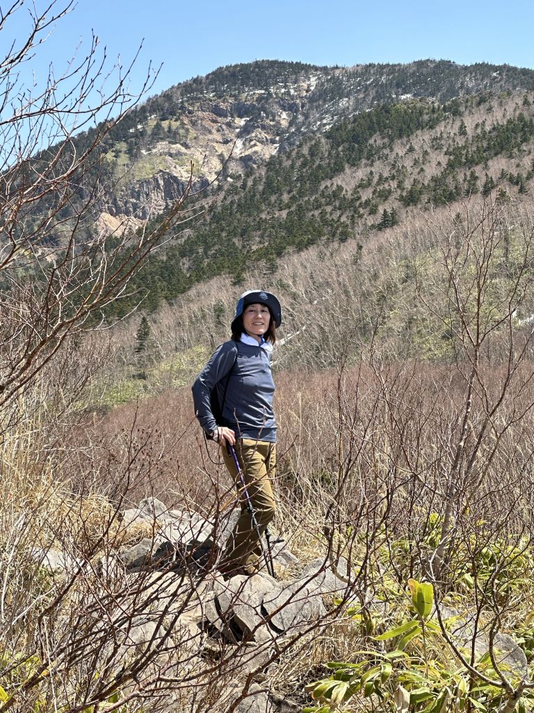
中間の高台から見る四阿山 View of Mt. Azumaya from a high point midway up the mountain

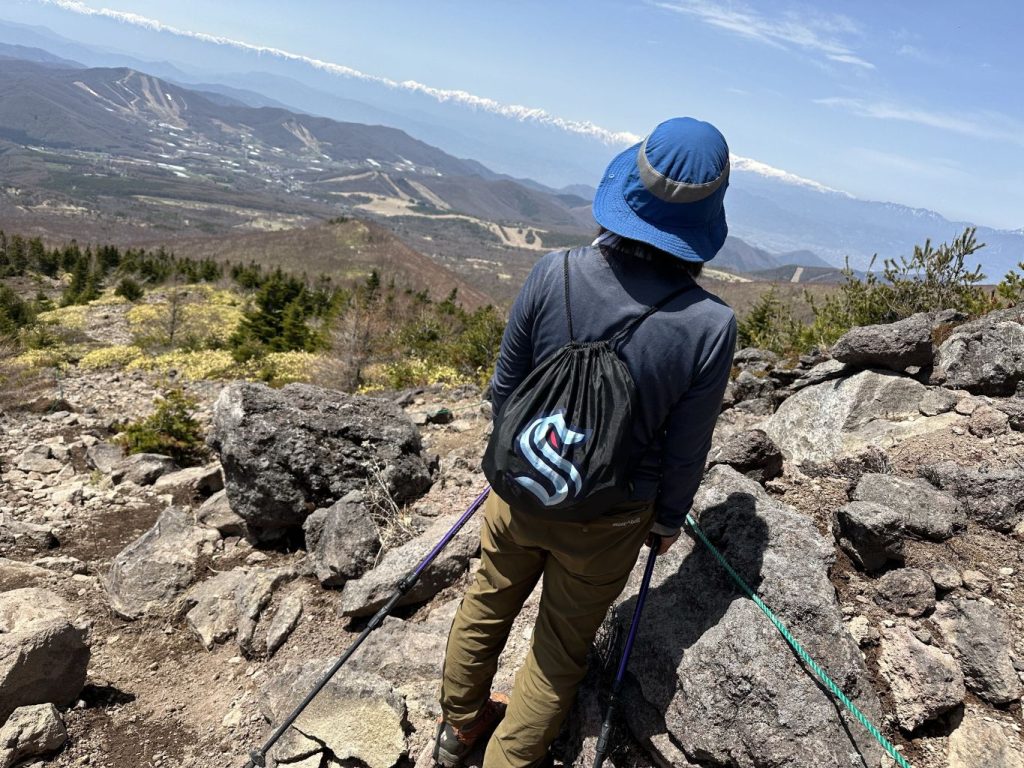
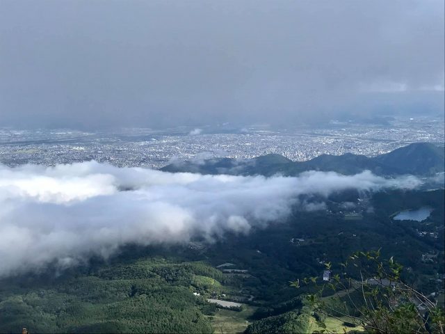
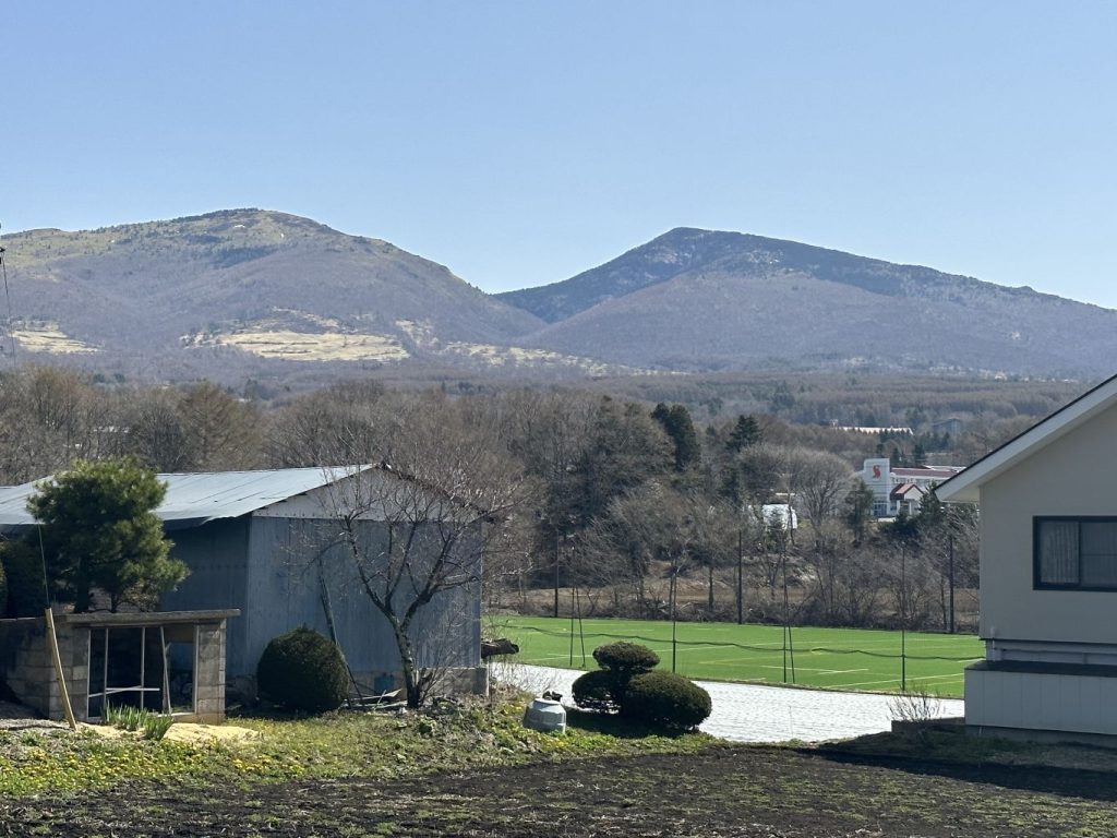
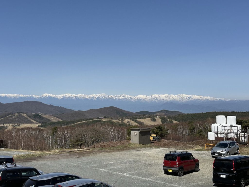
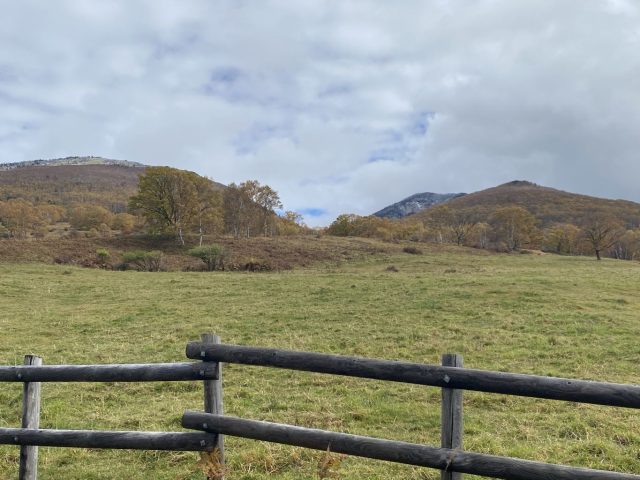
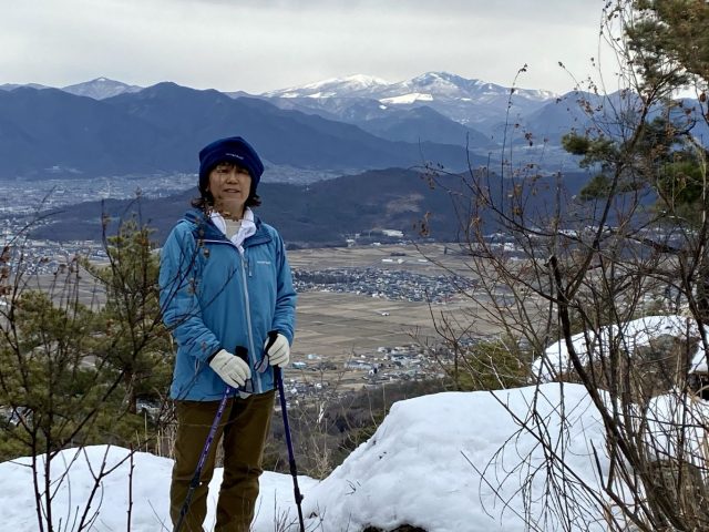
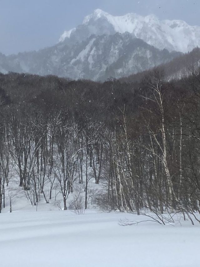
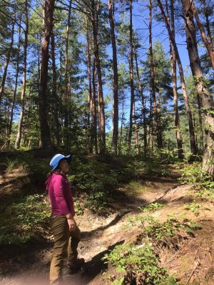
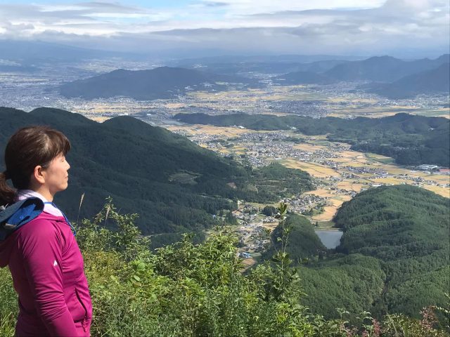
菅平高原を見下ろす 背景に北アルプス Looking down over Sugadaira Highlands with the Northern Japanese Alps in the distance

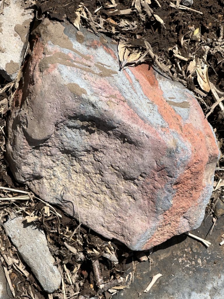
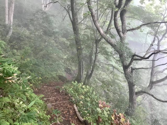
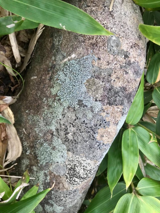
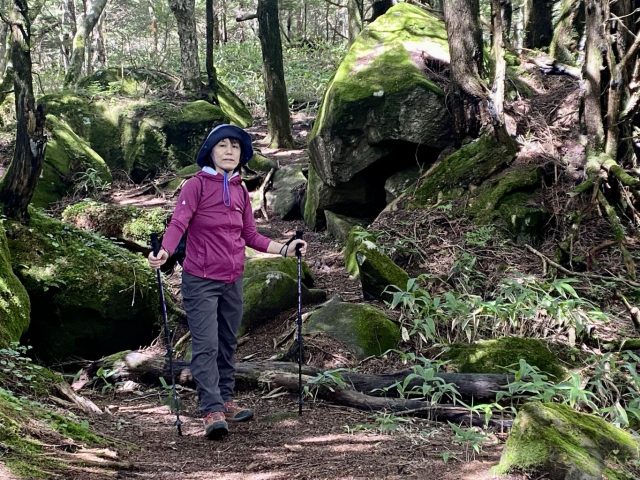
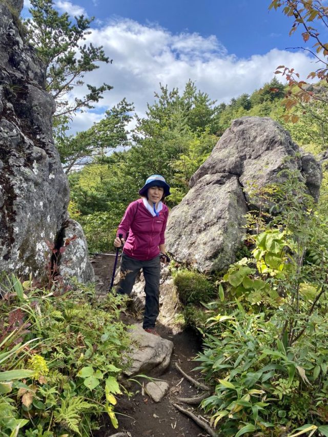
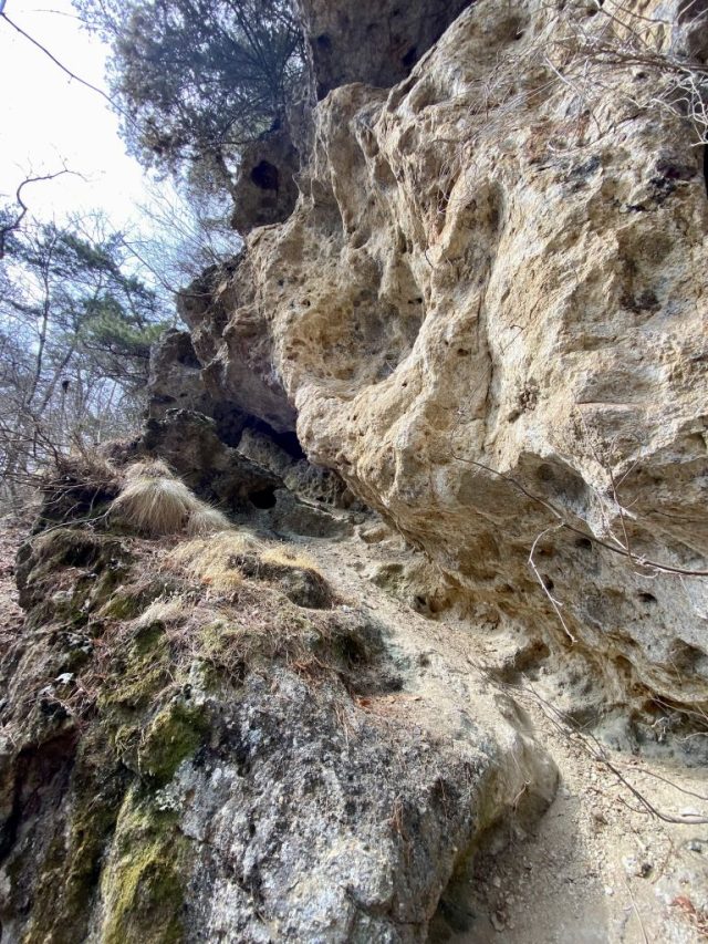
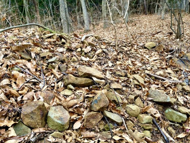
登山道は面白い地質を通る。時に赤っぽい石、時に青っぽい、他の場所に黒い土。火山の影響かな? この石は赤と青のハイブリッド。 Interesting geology along the path. Some areas with reddish rocks and dirt, some with blue rocks, and others with dark black earth. We could sense the ancient volcanic activity. This rock was a hybrid of red and blue.

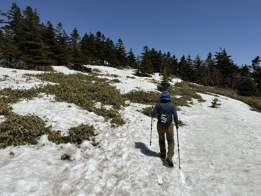
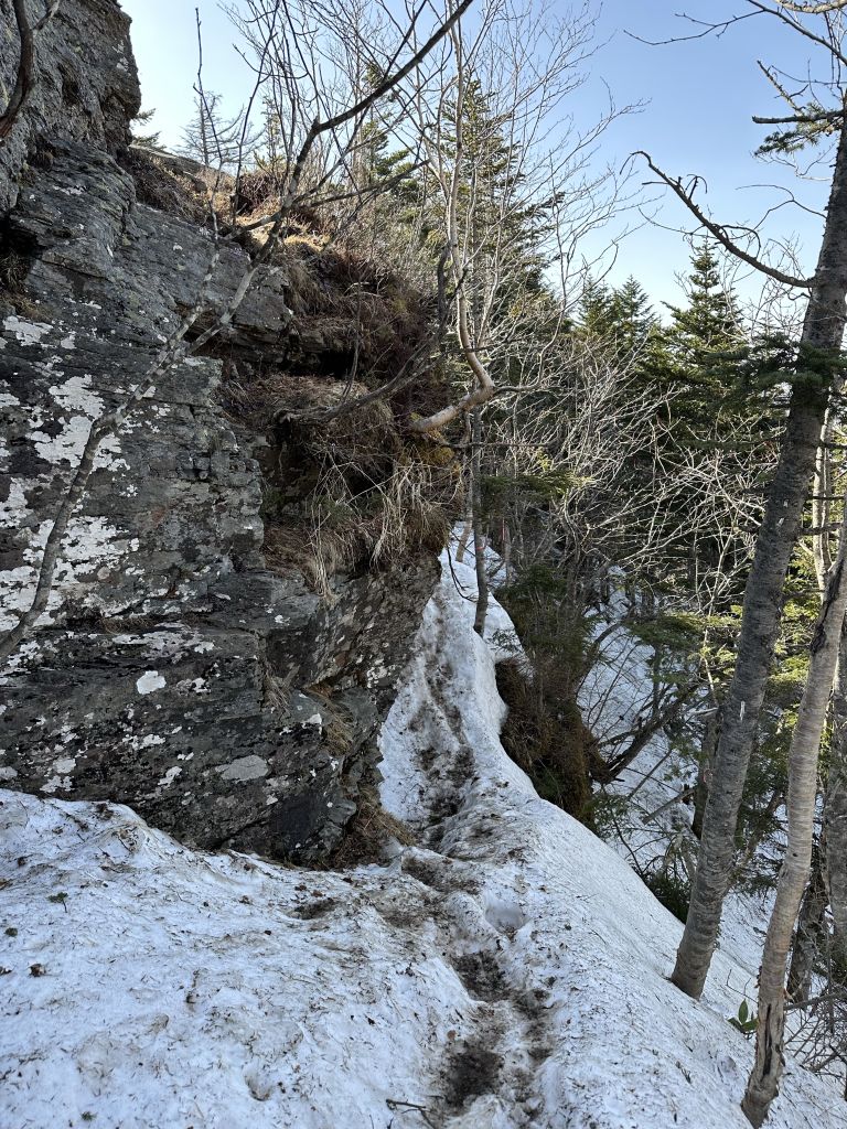
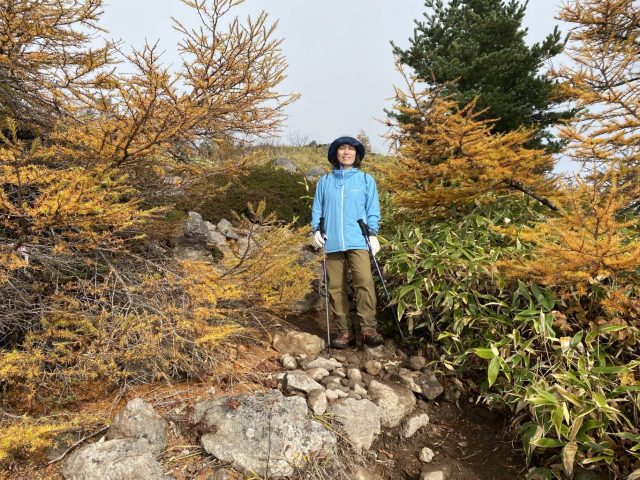
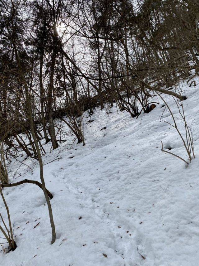
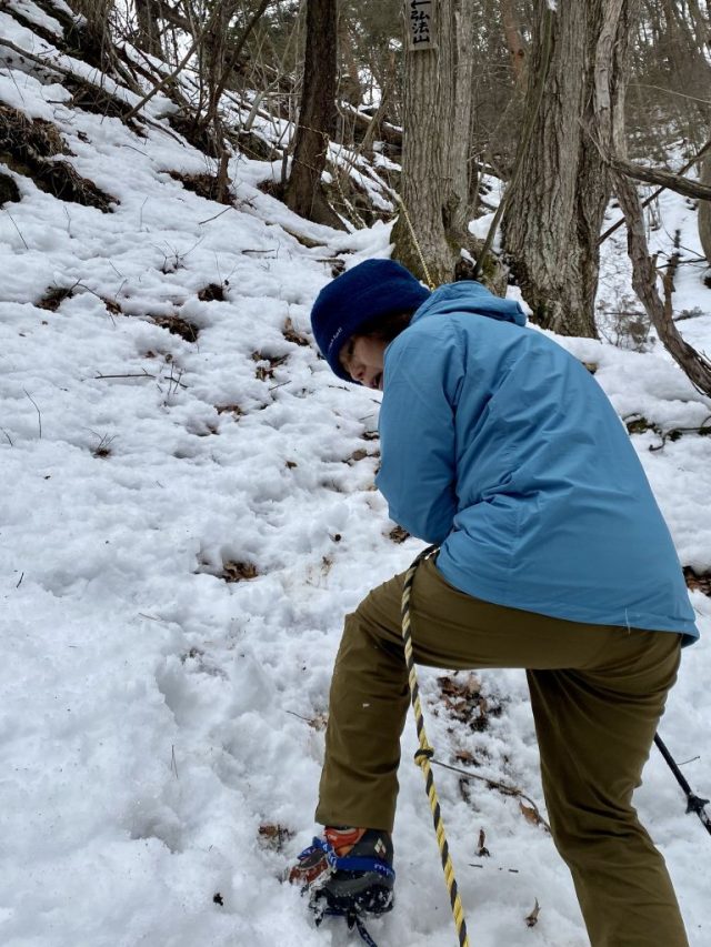
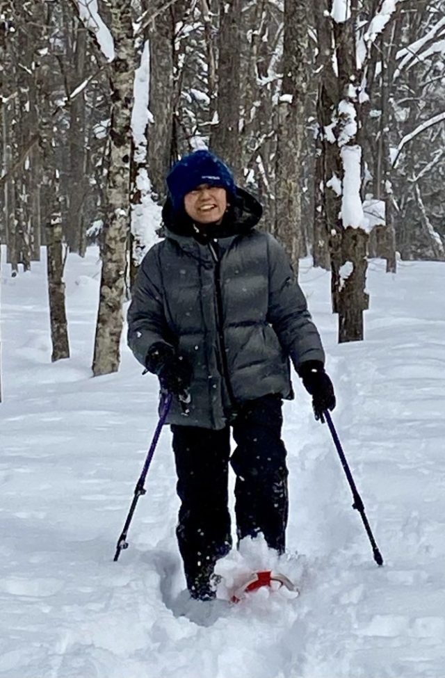
4月20日の時点で所々に雪が残っていて、アイゼンは必要だった。 As of April 20th, there was still snow in several places. We definitely made us of our crampons.

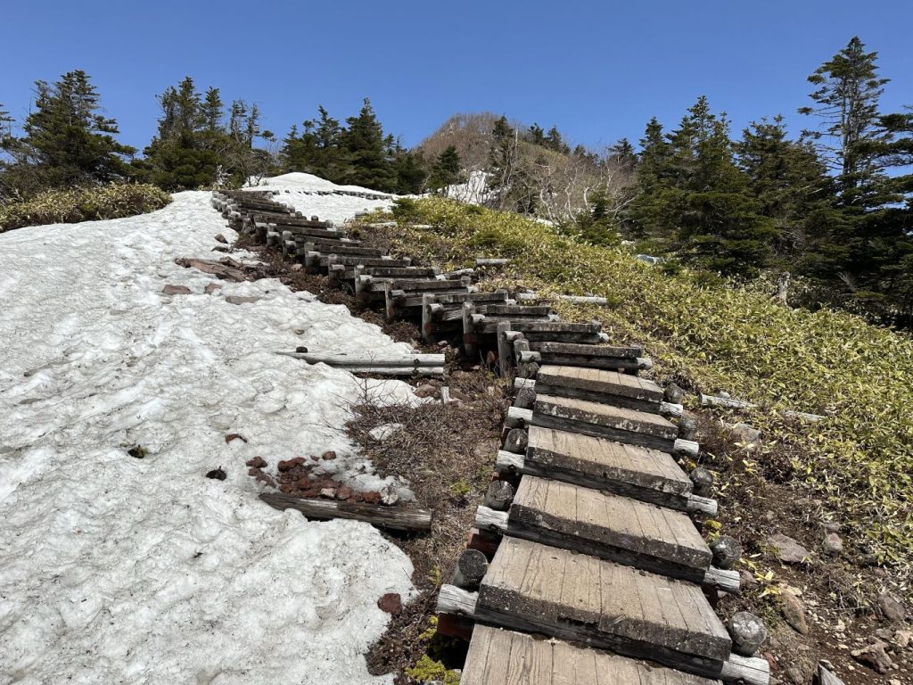
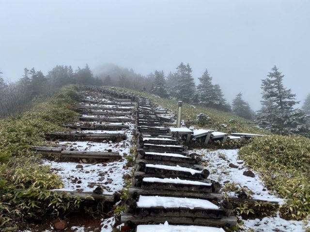
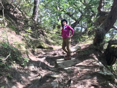
四阿山の頂上付近の木の階段 Wooden stairs near Mt. Azumaya's summit

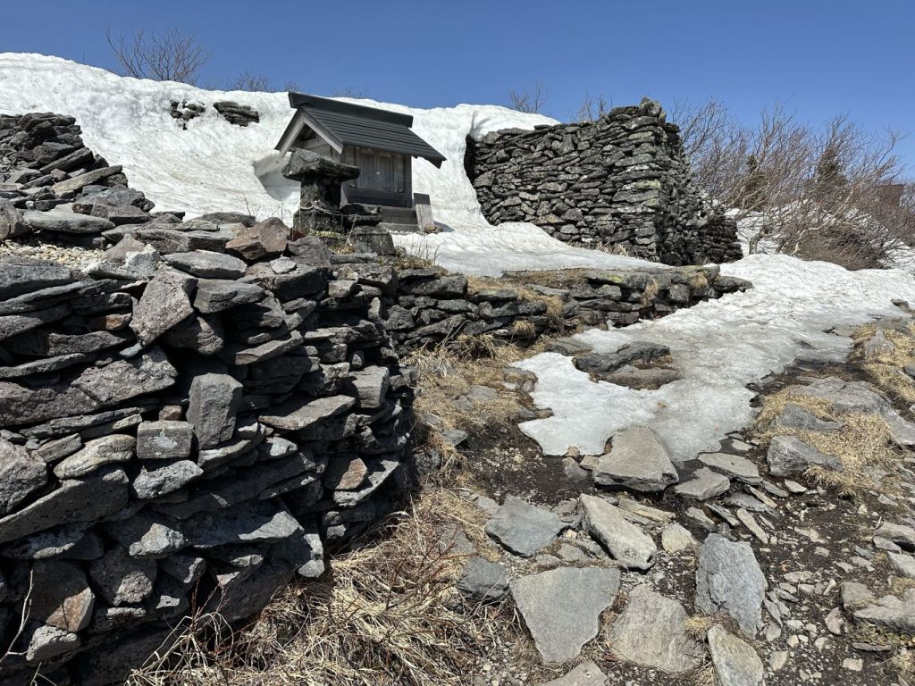
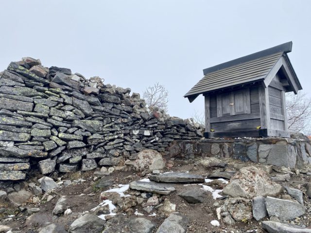
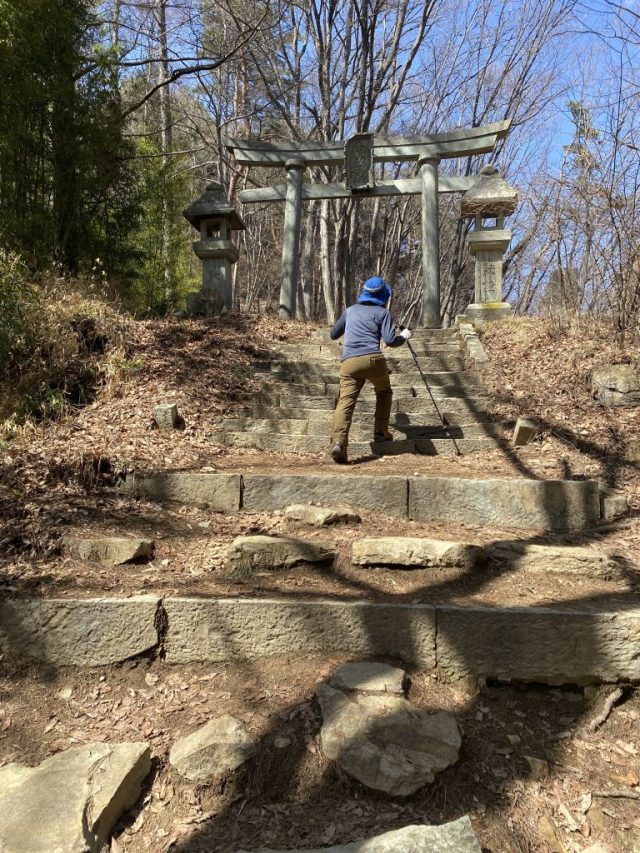
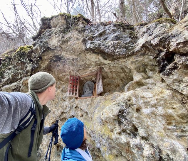
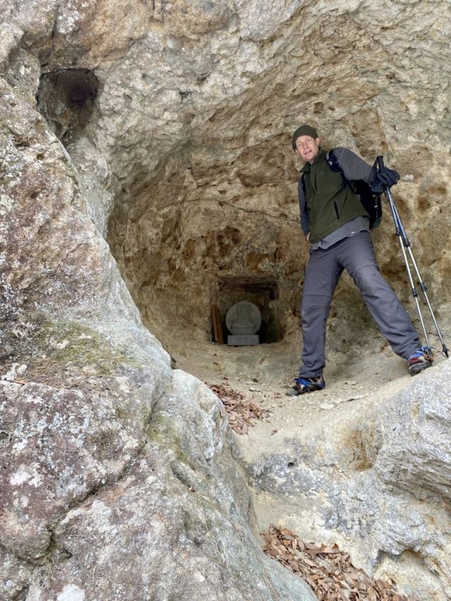
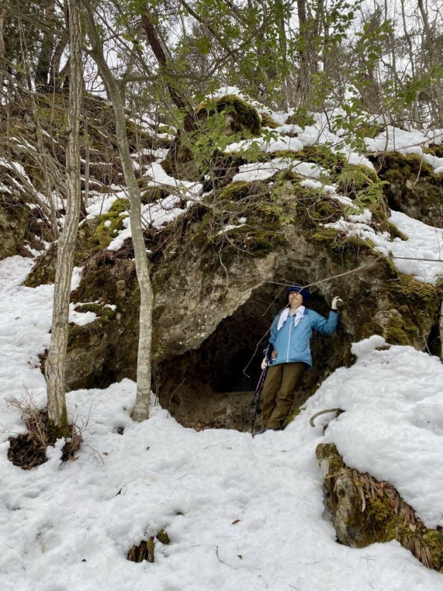
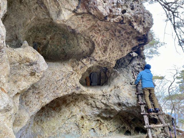
四阿山の頂上にある宮。真田地区の山家神社の説明版によると、戦国時代に四阿山が修験道の聖地だったのでその神社が登山口だったそうです。 Shrine at the top of Mt. Azumaya. According to a sign at Yamaga Shrine down back at the Sanada District, Mt. Azuyama was a pilgrimage destination back in the Warring States era, with Yamaga Shrine as the trailhead.

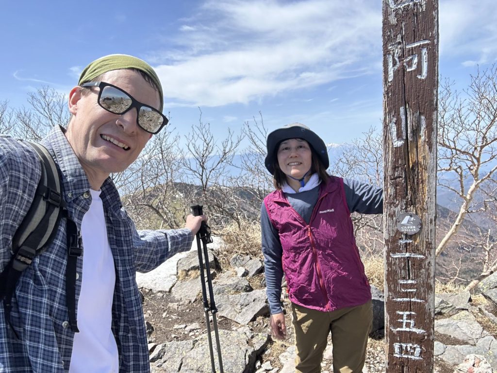
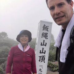
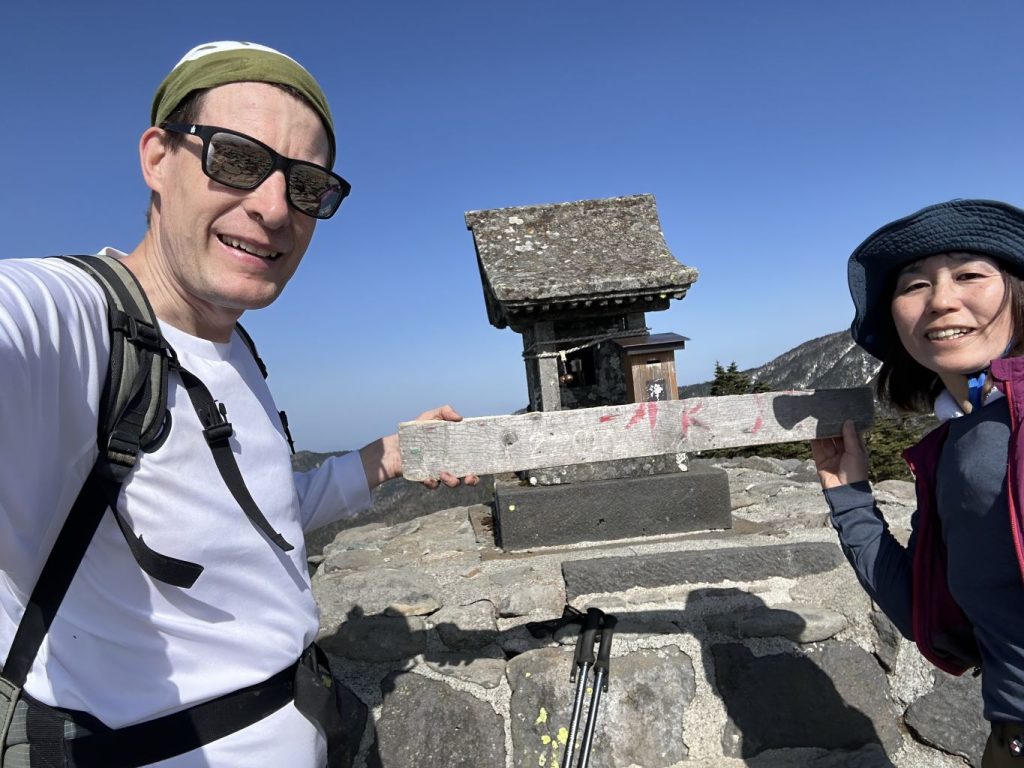
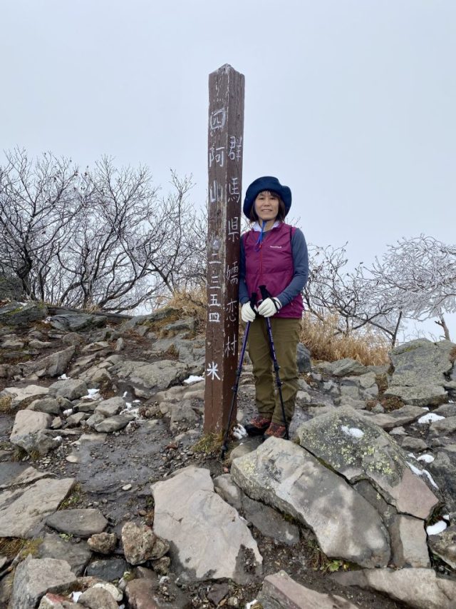
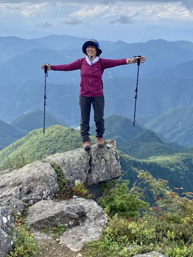
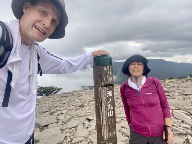
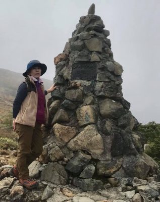
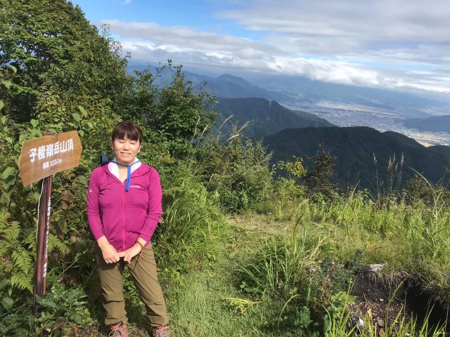
Mt. Azumaya's summit (2,354 meters elevation)

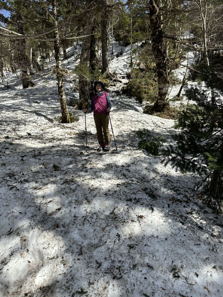
四阿山の北側の下り。アイゼンに感謝! Descending Mt. Azuyama's north side. Thank goodness for crampons!

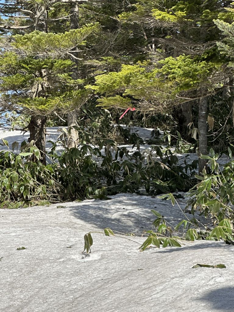
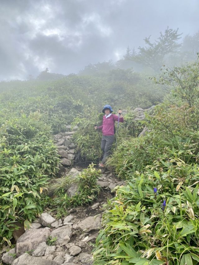
道が雪で隠れて、足跡も少なく、ピンクリボン探しでした。 The path was covered in snow, and footprints were hard to find, so we had to rely on the pink trail markers.

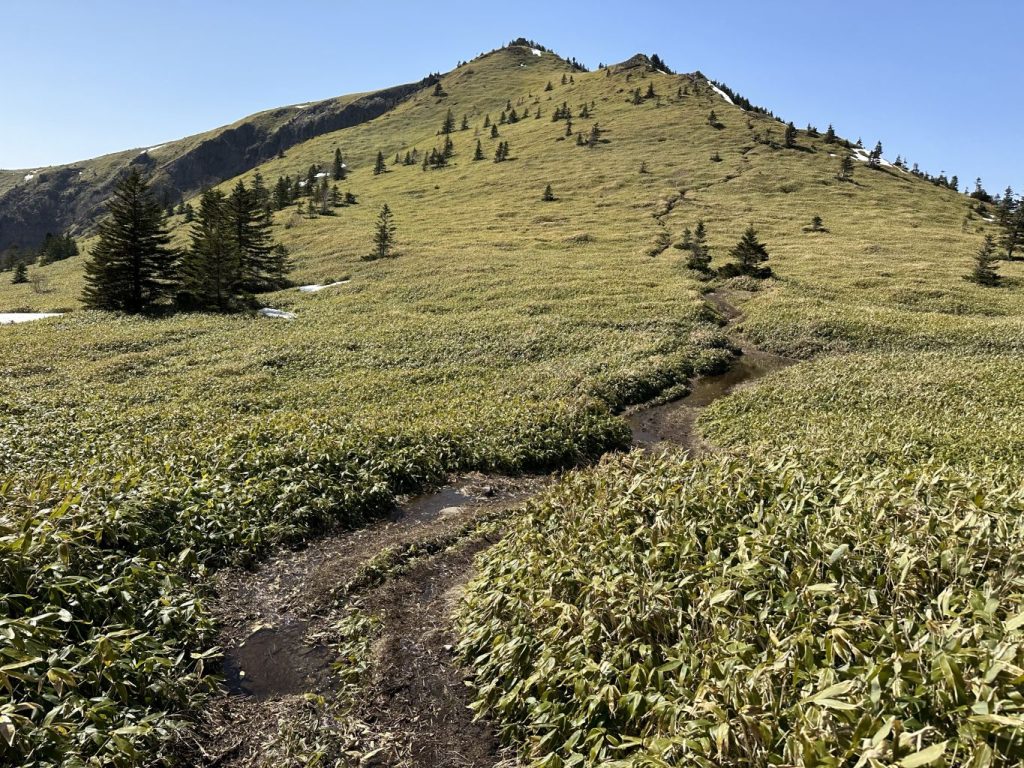
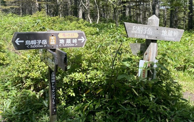
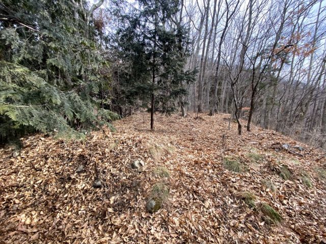
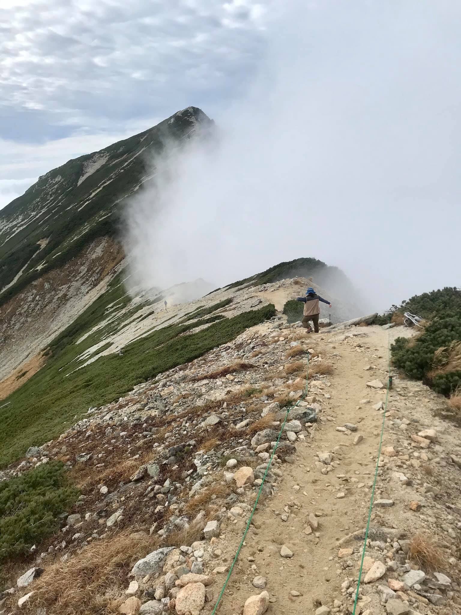
二つの山の間の笹平(標高2,040m) これから根子岳の頂上へ The bamboo grass flat between the two peaks (elevation 2,040m). From here we started the ascent to the top of Mt. Nekodake.

笹平を見下ろして、背景は四阿山 Overlooking the bamboo grass flat, with Mt. Azumaya in the background

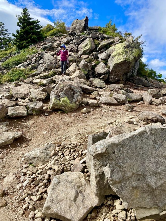
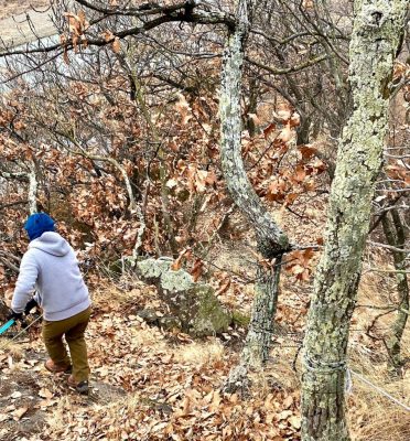
根子岳の頂上付近の岩場。ドキドキする道。 Boulders near the summit of Mt. Nekodake. The path is not for the faint of heart.

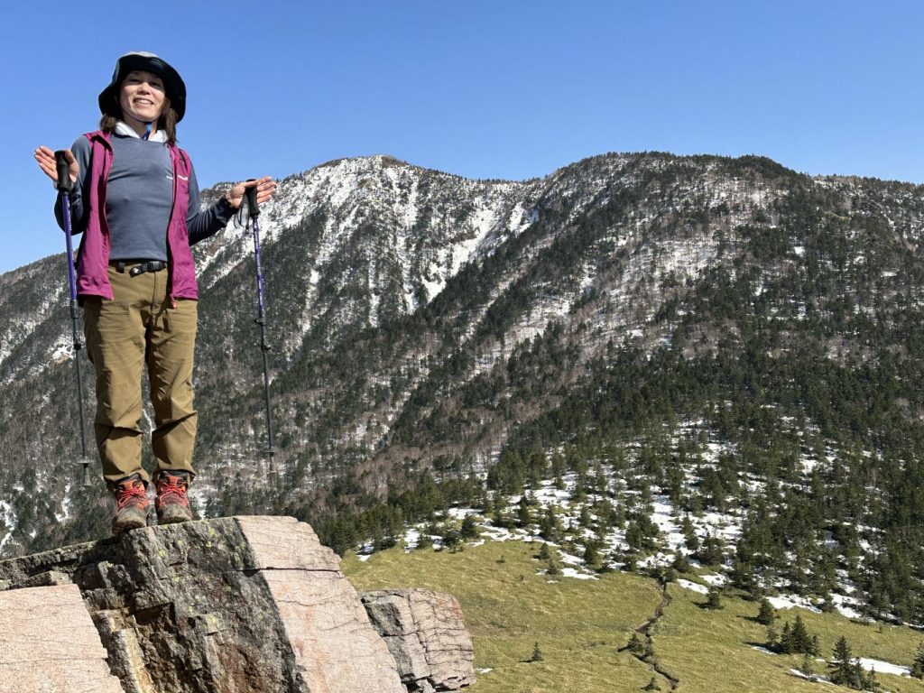
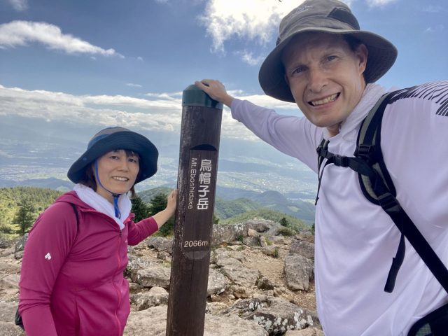
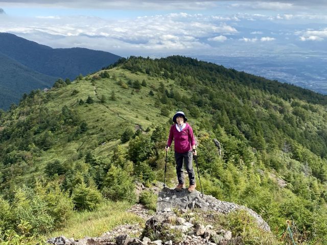
根子岳の頂上 Mt. Nekodake summit 2,207m

根子岳の頂上から牧場へ降りる道 Descent from Mt. Nekodake's summit back to the pasture trailhead

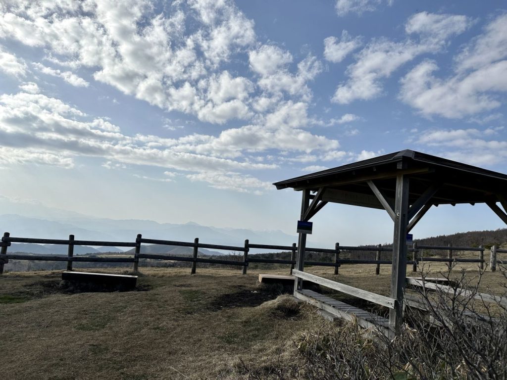
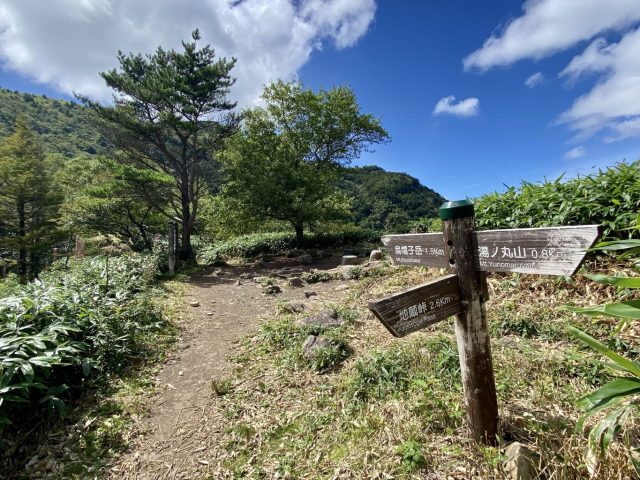
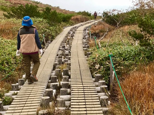
途中に牧場の上で展望台の東屋がある Gazebo at the viewpoint at the top of the pasture.

左は牧場、右は白樺の林 Pasture to the left, birch woods to the right.

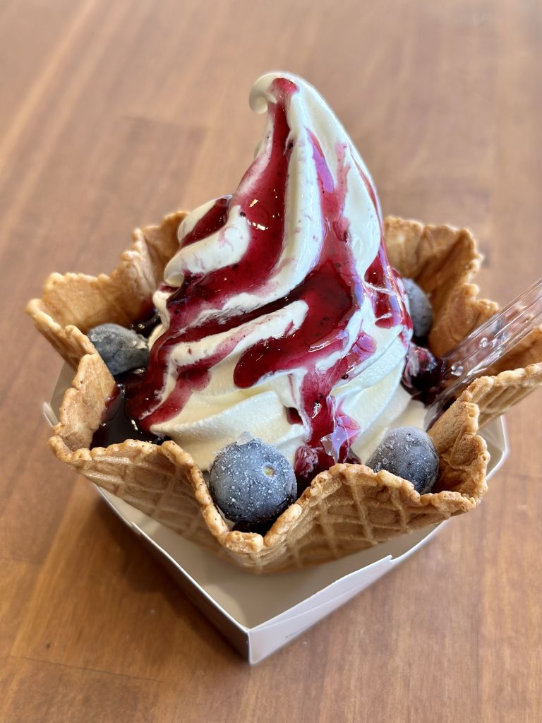
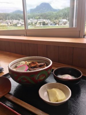
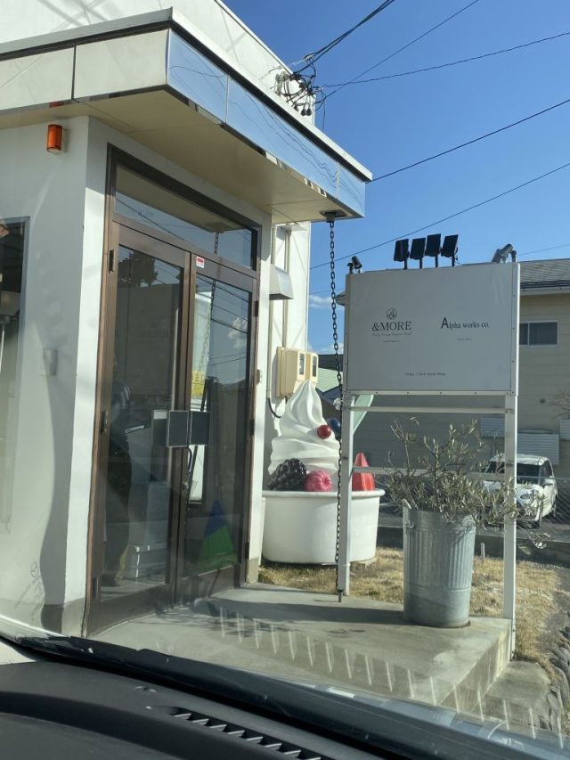
下りてからのお勧めのソフトアイス; 菅清園 Best spot for post-climb soft-serve ice cream: Kanseien in Sugadaira's central village

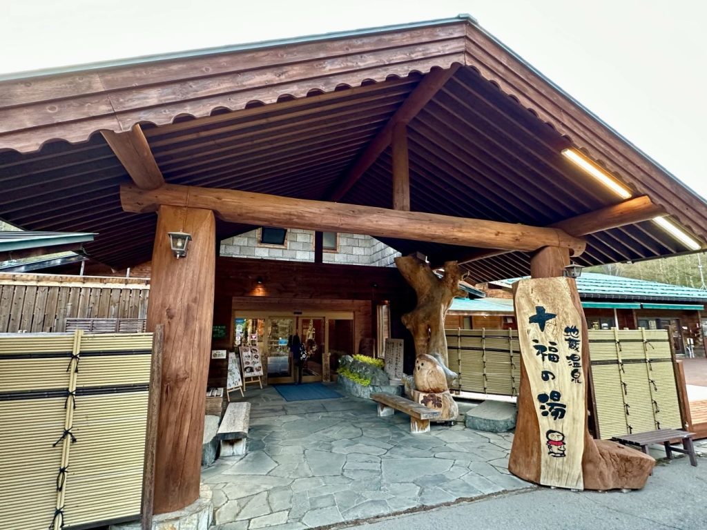
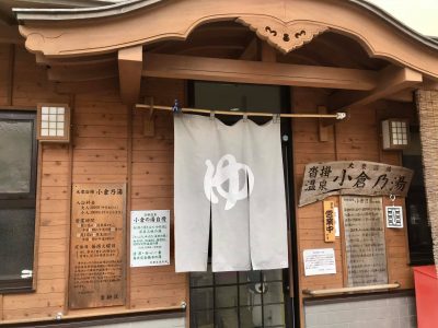
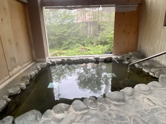
今回の立ち寄り湯; 十福の湯 外の広い石風呂と周りの庭園(枝垂れ桜も山桜も満開だった!)で体の充電が出来た。 Our post-climb bath this time was Juppuku no Yu. With it's outdoor bath made of majestic rocks and glorious garden (the weeping cherry trees and wild cherry trees on the nearby hillside were in full bloom), we rejuvenated our sore bodies.

一つの駐車序から二つの山を登れるコースが少ない。菅平牧場から四阿山と根子岳の両方を廻れるのはすごく嬉しい。時間はかかる(余裕をもって7時間で計算したらよいと思う)けど、ダブル達成感になる。私達は牧場⇒四阿山⇒根子岳⇒牧場(つまり、反対時計回り)した。夏は笹平から根子岳まで木影がないけど、四阿山までは松林の中だからその方が涼しいでしょう。(つまり、夏は統計回りがおすすめ)

There aren't too many places where you can climb two mountains from one starting point, so being able to summit both Mt. Azumaya and Mt. Nekodake from the Sugadaira Pasture trailhead is pretty special.  It takes a long time (I suggest planning on 7 hours to be safe) but you get twice the summitting satisfaction.  We went Pasture - Mt. Azumaya - Mt. Nekodake - Pasture (i.e. reverse-clockwise).  However, in the summer, the path from the bamboo grass flat up to Nekodake doesn't have any tree shade whereas the ascent to Azumaya would be through a pine forest (thus relatively cooler) so I suggest circling clockwise.

四阿山 Mt. Azumaya 2,354m

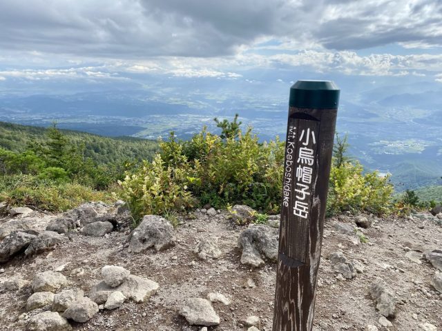
根子岳 Mt. Nekodake  2,207m

登山道長さ Trail Length 4.6km + 2.5km + 2.6km

標高差 Elevation Gain 754m + 167m (1,600 ⇒ 2,354 ⇒ 2,040 ⇒ 2,207 ⇒ 1,600m)

一周 Total time 6:30

体力 Level of Exertion ●●〇

難度 Level of Difficulty ●●〇

景色 Views / Sights ●●●

表記 Signage ●●〇

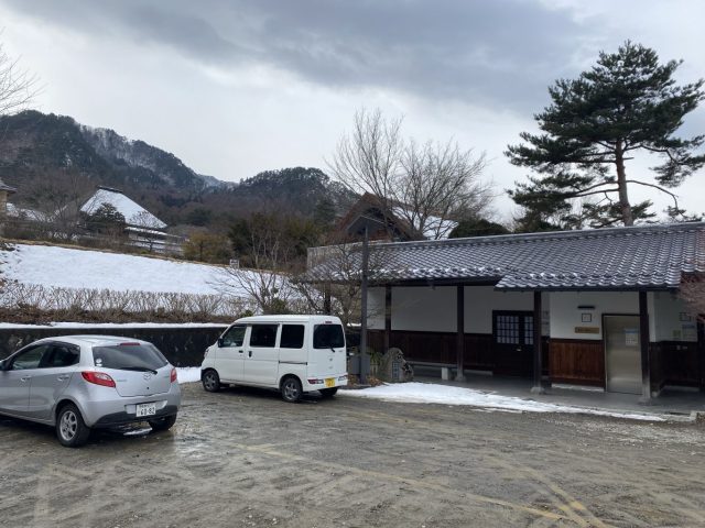
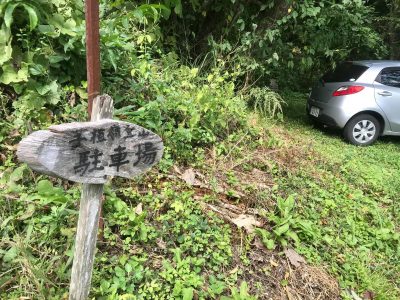
登山口 Trailhead 🚙Px30 WC有りYes https://goo.gl/maps/hax3tskBwJWLbtxbA

入場料 Entrance Fee ¥200/pax


お勧めの登山: 東御市・千曲川を見下ろす烏帽子岳 Recommended Climb: Mt. Eboshi Overlooking Tomi City and the Chikuma River Valley

2022.09.05: 信州の山 Nagano’s Mountains

烏帽子岳は東御市の湯の丸高原と言う便利な登山口(我が亀清旅館から車で45分)から割と緩やかな歩きやすいトレールで2066mの頂上まで登れる。湿原のボードウォークや高山植物、火山の地形(浅間山と同じ火山群)、そして頂上からの絶景。

Mt. Eboshi is a relatively easy-going climb from a very convenient trailhead (Tomi City’s Yunomaru plateau, a convenient 45 minutes by car from our Kamesei Ryokan). The view from the 2066m peak overlooks Tomi and the Chikuma River Valley below, and along the way there’s a marsh with a boardwalk, a treasure trove of alpine flowers, and reminders of ancient volcanic activity.

烏帽子岳の特徴な形の頂上は上田市(特に丸子地区)と東御市のほとんどどこからでも見える。標高が割と高いので冬に真っ先に白くなる。しかし、登山道の勾配が優しいので小さい子供やご年配の方に人気。前回に登った時に小学生は百数十人た通り違った。今回は週に1〜2回登っている70代のおじさんと行き合った。「富士山を見るのに梅雨前の4〜5月だ」とアドバイスをくれた。

Mt. Eboshi’s distinctive 2-pronged peak is a prominent feature of the skyline in Ueda City (especially the Maruko District) and of course Tomi City. Its relatively tall height means it’s one of the first mountains in the area to be covered in snow in the winter. “Eboshi” refers to the high-peaked hat worn by nobility in the ancient Heian Era for ceremonies. The ascent is relatively mild hence the trail is popular with schoolchildren as well as elderly climbers. On our first climb we passed a group of over 100 elementary students. This time we met a guy in his 70s that climbs Eboshi several times a week. (His advice: May and June are best for seeing Mt. Fuji from the peak.)

烏帽子岳 Mt. Eboshi 2066m

登山道長さ Trail Length 3.8km 片道 + return

標高差 Elevation Gain 366m

登り Ascent 1:45, 下り Descent 1:30

体力 Level of Exertion ⚫️◯◯

難度 Level of Difficulty ⚫️◯◯

景色 Views / Sights ⚫️⚫️⚫️

表記 Signage ⚫️⚫️◯

登山口 Trailhead 🚘Px100+ 🚾有りYes

湯の丸から見る烏帽子 Mt. Eboshi as seen from Yunomaru
登山口近くの臼窪湿原 Usukubo Marsh near the trailhead
唐松と笹の世界 World of aspen trees and bamboo grass
苔の世界 World of Moss
最初の分岐点 (表記の距離は統一して欲しい)First trail split
烏帽子と湯の丸山の間の鞍部 Col between Mt. Eboshi and Mt. Yunomaru
火山の赤土 Red Volcanic Soil
背景に塩田平と千曲川 Chikuma River Valley in the distance
烏帽子岳の頂上 Mt. Eboshi’s summit

廻り道: 湯の丸山。Side Trip Up Mt. Yunomaru

烏帽子岳から標高1850mの鞍部まで降りて、山登りがまだ足りない方に標高2101m湯の丸山と言う手もあります。800mの短い距離で標高250m上がると言う激坂だけど、達成感はバッチリ。登山口である地蔵峠まで降りる途中につつじ平とスキーのグレンデ(夏は牧場で、牛のフンは要注意!)を通る。山の天気はすぐ変わるので、私たちが通った時に霧になった。ちゃんとした装備しましょう♪

If climbing Mt. Eboshi wasn’t enough exercise for you, from the col (1850m) you can take the short but steep 800m long trail to the top of Mt. Yunomaru (2101m). You’ll get your exercise in addition to a well-deserved sense of accomplishment. The trail back down to the parking lot at Jizo Pass goes through an azalea field as well as one of the ski slopes (watch out for cow paddies as the slope is used for grazing in the green season). Mountain weather tends to be fickle — on our descent we were suddenly enveloped in fog. Use caution and be prepared!

Mt. Yunomaru summit
厳しい勾配に霧 Steep trail with fog

立ち寄り湯: 湯の丸高原ホテル Post-Hike Onsen: Yunomaru Kogen Hotel

登山口である地蔵峠に湯の丸高原ホテルがあって、日帰り入場が可能。塩素の匂い無く、山の自然を楽しめる露天風呂あり、汗を流すのに最適だ♪ Located at the Jizo Pass trailhead, Yunomaru Kogen Hotel allows day-use of its onsen baths. The outdoor bath has an especially lovely setting, and is perfect for washing away the sweat and dust from the hike.

お勧め里山登り: 太郎山(上田市のシンボル) Recommended Hike: Ueda City’s Beloved Mt. Taro

2022.04.06: 信州の山 Nagano’s Mountains

(English follows) 上田市のシンボルとして上田城に負けないぐらい太郎山が愛されてます。年に400回に登っている市民もいるようです。人気のバーチカルレースも毎年5月に太郎山で開催されます。私たちが登った日に走って来たお兄さんがいまして、聞いたら26分で登ったそうです。(私たちは1時間20分かかりました!)表参道コースは109m毎に丁石があって、途中に山城跡があり、中腹に巨大な石鳥居をくぐり、頂上近辺の神社に超ミニな鳥居、飽きないコースです。それより、頂上からの眺めが素晴らしい!私たちが登ったのは雨が降った後の日だったので空気が綺麗でずっと眺めてました。上田市街と塩田平は勿論見下ろせたが、遠くの北アルプス、南アルプス、八ヶ岳連峰、そして富士山も見えた!太郎山の人気の理由は分かります!

Mt. Taro is along with Ueda Castle one of Ueda City’s two most endearing symbols. The trail to the peak is so popular some people climb it over 400 times a year. A prestigious Vertical Race takes place every May. In fact, we met one runner who said he made it to the top in 26 minutes. (For the record it took us an hour and 20 minutes!). The entertaining trail is dotted by stone markers every 109 meters, it passes near the the remains of an ancient samurai fort, halfway up the mountain it ducks under a massive stone Torii gate, and conversely at the shrine near the peak is an ankle-high Torii. But the biggest reward for climbing Mt. Taro is the spectacular view from the summit. We sat and absorbed the vista for over half an hour. Not only can you look down on central Ueda and the entirety of the Shioda Plain but you can gaze out and see the both the Northern and Southern Alps as well as the Yatsugatake Range and even Mt. Fuji.

上田市を見下ろして、奥は富士山 Looking down upon central Ueda with Fuji-san on the horizon

太郎山 Mt. Taro 1,164m. 距離 Length 2.1km. 標高差 Elevation Gain 584m. 登り Ascent 80 min. 下り Descent 60 min. 難度 Level of Difficulty: 中級 Medium. 苦労 Effort ●●○. 技術的 Technical ●○○. 登山道の状況 Trail Condition ●●●. 表記 Signage ●●○ (後何メータかの表記が欲しかった Needs distance markers). 2022.04.05

太郎山は上田市のどこからでも見えます Mt. Taro can be seen from anywhere in Ueda City
登山口 駐車スペースは道沿いに10数台分 トイレ無し Trailhead. Parking for 10+ cars along the road. No toilet.
丁石 Stone distance marker
途中の山城跡 Castle remains
山の中腹に石の階段、安堵と巨大な鳥居。誰がどうやって運んだ⁉️ Halfway up, stone steps, lanterns and Torii gate. Who carried these up, and how?!
頂上近辺の神社 At the shrine near the peak
絶景 Panoramic view
お疲れフローズンヨーグルト Post-climb Frozen yogurt https://and-more.shop

お勧め里山登り: 弘法山(塩田平) 信仰と歴史の探検 Recommended Hike: Mt. Kobo. A Mystical and Samurai Adventure

2022.03.01: 山城 Mountaintop Forts, 季節 Seasons, 長野に来る理由 Reasons to Come to Nagano, 信州の山 Nagano’s Mountains

上田市塩田平の前山寺の裏にある弘法山はさほど大きくないけど頂上からの眺めは素晴らしい。それより、塩田城の名残りそして頂上付近の33石仏探検、無茶苦茶楽しい山です。私はアイゼンが必要ぐらいに雪が積もっていて尚スリリングでした。

Kobo-Yama is the smallish mountain behind national treasure Zenzan-ji Temple on Ueda City’s Shioda Plain. Despite its short stature the view from the summit is stunning but what makes Kobo-Yama distinct are the remains of the Warring State era Shioda Castle and the adventure of finding the 33 stone Buddhas tucked into crevices around the peak.

弘法山から見下ろす塩田平 Looking down on the Shioda Plain from Mt. Kobo
塩田城跡(虎口)Shioda Castle: remains of the Tiger Gate
33石仏(弘法の眼)Searching for the 33 stone Buddhas — the Eye of the Kobo (Priest)

弘法山 Mt. Kobo (842m)

距離 Length 1.3km. 標高差 Elevation Gain 280m. 登り Ascent 90 min. 下り Descent 90 min. (探検しながら、前山寺見学含め)難度 Level of Difficulty: 初心者 Easy (冬は雪でアイゼン必須・中級 In winter Moderate due to needing crampons when snow). 2022.03.01

前山手の駐車場(とトイレ)Zenzan-ji parking lot (with toilet)
登山口(後は弘法山) Trailhead (Mt. Kobo in the distance)
足跡がガイド Footprints were our guide
一つ目の石仏見付け♪ Found the first stone Buddha
岩に階段が掘られた Stairs carved in stone
岩場 stone cliff
高さ2mの穴も Some hollows were 2m tall
他は高さ1.5m Others only 1.5 meters tall
背景は菅平 Sugadaira in the distance
塩田平と背景は戸隠山 The Shioda Plain with Mt. Togakushi in the background
塩田城城・虎口 Shioda Castle Remaiy
前山寺の未完成の三重塔 Zenzan-Ji’s “Unfinished” Pagoda

アクセス: お車なら前山寺は国宝なので沢山の看板が出てます。公衆トイレに広い駐車場あり。交通機関なら上田駅から別所線で塩田町駅、⑧信州の鎌倉シャトル線で前山寺バス停(本数と運行期間に限りあり)。 亀清旅館から車で20km、40分。戸倉駅から上田経由で塩田町まで約45分、バス20分又はタクシー5分。https://www.city.ueda.nagano.jp/uploaded/attachment/3023.pdf

ACCESS: By car, Zenzan-ji Temple is a National Treasure so well-signed. Use the large parking lot by the public toilet. By train, from Ueda Station take the Bessho Line to Shiodamachi and transfer to Bus #8 to the Zenzan-ji stop (frequency and operation limited). From Kamesei Ryokan, 20km (40 min.) by car. From Togura Station via Ueda 45 min. to Shiodamachi +20 min. bus or 5 min. taxi.

コース: 正面の登山口と塩田城経由の二つのコースがあるからループ可能。33石仏探しも含めて中嶋豊さんの「信州山歩き地図・里山編III北信東信」がマスト。COURSE: Two trailheads (official one above Zenzan-ji Temple and via Shioda Castle) so can be done as a loop. For both the course and for finding the 33 stone Buddhas, get Yutaka Nakajima’s 3rd hiking book.

お勧めのスノーシュー: 戸隠 Recommended Snowshoeing: Togakushi

2022.02.03: 季節 Seasons, 長野に来る理由 Reasons to Come to Nagano, 信州の山 Nagano’s Mountains

戸隠奥社の杉並木がパワースポットで大人気ですが、実は雪の時も素敵で、なおかつスノーシューに適しています。

信州の冬はスキーやスノーボードが世界的に有名ですが、スノーシューも楽しいです。

The giant cedar trees of Togakushi’s Okusha (Inner Shrine) in the mountains above central Nagano City are popular as a sort of Power Vortex. The cedars are especially impressive during the winter and the area is our favorite place for snowshoeing.

戸隠奥社の杉並木。雪と素敵なコントラスト。The towering cedars lining the path to Togakushi’s Inner Shrine

信州の冬はスキーやスノーボードが世界的に有名ですが、スノーシューだんだん話題になってきています。私たちは菅平、乗鞍高原、御嶽山など県内のあちらこちらでやっていますが、一番の気に入りスノーシュー場所は戸隠奥社です。冬でしか行けない見どころがあるし、雪が深くて普通な靴がだめですから。

Winter in Nagano is synonymous with skiing and snowboarding and rightly so. But steadily snowshoeing is gaining in popularity. We’ve gone snowshoeing throughout the prefecture but keep returning to our favorite: Togakushi. It has areas that are only accessible when covered in snow and would be impossible with just regular shoes.

亀清の女将: スノーシューの笑顔 Kamesei’s proprietress in her happy place snowshoeing at Togakushi

2月の上旬に行ったら雪が1.5mぐらい積もってました。奥社入り口で駐車して、スノーシューを付けて鳥居をくぐって杉並木が始まる場所に位置している随神門へ向かいました。

When we went in early February there was about 5 feet of snow. We parked at the Okusha entrance, put on the snowshoes, passed the Torii gate and headed towards the Zuijinmon Gate which marks the beginning of the cedars.

入り口の鳥居。随神門まではよく通られて普通な靴で行けるがその道から一歩離ればスノーシューが必要。The entrance Torii. The path to Zuijinmon is well-enough traveled so that regular shoes could suffice but take one step off the path and you’ll need snowshoes.
ミズナラ大王 “King of the Forest” Oak

入り口の鳥居から随神門までは約1km。そのちょうど真ん中点辺りから足跡が右斜めに進む。追いつけばこの森の王様に辿り着く。

随神門を通ればパワースポットの杉並木へ

パワースポットで有名の杉並木は雪とのコントラストがまた格別です。太陽が積もっている雪から反射してその特徴の模様の杉皮が光って神秘的です。人間が小さく感じます。

クマさんの目印 Follow the golden bear

杉並木を見てからクロスカントリースキーのコース(黄色い熊のマークが目印)が随神門と鏡池を結ぶ。このコースはスノーシュー(もしくはスキーの板)が必須。

天命稲荷神社を通って Pass by the Tenmei Inari Shrine and its rows of vermilion Torii gates
長〜い影 Long shadows
鏡池の上から見る戸隠山 Togakushi Mtn. as seen from on top of Mirror Pond

冬で鏡池に雪が積もるから上に歩ける。戸隠連峰が迫力ある背景になります。ピクニックには最適な場所。 In winter Kagami Ike (“Mirror Pond”) is covered by a layer of snow so thick that you can walk out on to the middle of the pond, meaning you can literally walk on water. With the towering Togakushi Range as a dramatic backdrop the pond makes a perfect place for a picnic.

いざ山城! 岩崎城経由で村上義清の葛尾城へ Samurai Forts: Climbing to Katsurao-jo via Iwasaki-jo

2021.02.07: 山城 Mountaintop Forts, 長野に来る理由 Reasons to Come to Nagano, 信州の山 Nagano’s Mountains

戸倉上山田温泉の近くの磯部地区から村上義清の葛尾城の登山道は米入り口コースの手前に岩崎城経由のコースもあって、先日に2人で登っでみた。岩崎城跡は整備されていないけど土橋や石垣が少し残っています。不思議な比丘尼(びくに)石や千曲川を見下ろせる絶景スポットがあって歯応えある山城ハイキングです。

Local samurai lord Murakami Yoshikiyo's main castle was Katsurao-jo, visible across the Chikuma River from our inn Kamesei Ryokan here in Onsen Town Togura-Kamiyamada.  From the nearby Isobe neighborhood, there are 2 trails to Katsurao-jo, one called the Kome-Iriguchi course that follows the old rear-entrance supply route, and one that passes by in intermediate fortress called Iwasaki-jo.  We recently hiked the latter.  Although hardly anything remains of Iwasaki-jo itself besides 'do-bashi' (earthen bridges) and some rock wall sections, the trail passes the mysterious Bikuni boulder and offers several panoramic viewpoints of the Chikuma River valley, so is well worth the climb.  (More info on Iwasaki-jo and Katsurao-jo from our friends at Jcastle.)

上戸倉宿から見た葛尾(上左)と岩崎城の跡地 Katsurao (upper left) and the location of Iwasaki Fort as seen from Upper Togura-juku

Traihead marker


秋和神社 Akiwa Shrine

比丘尼石 Bikuni Rock

村上義清の奥さんが武田信玄の包囲攻撃から逃げた時に「ここで故郷の住民の永遠の幸せを祈願し化石となった」と書いてあります。When Takeda Shingen laid a siege to Murakami Yoshikiyo, he had his wife escape down this route.  According to legend, the princess stopped here and prayed for the local people so hard she turned into this rock.

二の曲輪の石垣 Stone rampart of the lower bailey

一の曲輪の跡 Site of the Upper Bailey

戸倉上山田を見下ろす絶景 Panoramic view of Togura-Kamiyamada

登った時期 2月上旬 Climbed early February

距離 Distance 岩崎城まで To Iwasaki-jo 200m (葛尾城まで to Katsurao-jo +500m)

標高 Elevation 登山口 Trailhead 400m, 岩崎城 Iwasaki-jo 610m, 葛尾城 Katsurao-jo 805m

時間 Course Time  岩崎城まで To Iwasaki-jo 20 min. (葛尾城まで to Katsurao-jo +30 min.)

難易度 Difficulty ★★☆☆☆  お勧め度 Recommendation  ★★☆☆☆

アクセス 車で戸倉上山田温泉から国道18号を登って、「磯部南」信号の70m先に左曲がって、岩崎踏切でしなの鉄道を渡って、Yで右曲がって、登山口は約50mで右手に。バスは温泉や戸倉駅から路線バス⑧五加戸倉線で磯部ミニ公園で降りる。

Access: By car from Onsen Town Togura-Kamiyamada, take Route 18 south towards Sakaki / Ueda.  Pass the Isobe-Minami signal and in 70m turn left, cross the railroad tracks, at the Y turn turn right, and the trailhead will be on the right in about 50m.  By bus, from the onsen or Togura Station, take the #8 "Goka-Togura" bus and get off at Isobe Mini-Park stop.

[mappress mapid="7"]


お勧めの登山: 初の北アルプスに唐松岳 Recommended Hikes: Mt. Karamatsu for 1st-Time Alpinists

2020.10.10: 信州の山 Nagano’s Mountains, その他 Miscellaneous

亀清旅館に一番近いアルプス登山が白馬連峰の唐松岳(2620m)。リフトで1830mまで登れるから本格的な北アルプスのデビューとしてお勧めのコース。軽くトレッキングしたい方には八方池まで登るのは良し、ハードな山登りしたければそのまま唐松岳まで「日本の屋根」の世界へ。

日本の屋根(唐松岳頂上と雲海)On top of the World (Mt. Karamatsu's peak looking over a sea of clouds)

私達は前日のお客さんを見送ってから白馬へ出かけた。登山口となる八方池山荘まで通常のルートは八方地区のゴンドラ「アダム」そして二つのリフトに乗り換えていける。(片道60分、往復で約3000円) 長野駅からの急行バスの八方バスターミナルからゴンドラまで歩けるから電車やバス交通には便利。車で行けば期間限定で黒菱第三リフトから1回の乗り換えで行けるけど、リフトまでの道があまりにもくねくねで結局ゴンドラ「アダム」経路の方が早い。(黒菱ラインは往復1200円.)アクセスの詳しく

標高1830mの八方池山荘から2060mの八方池までは約60分(木の板のコースは少し長いけど、歩きやすい方)。晴れていれば水面で白馬三山が映るので神秘的な景色。(残念ながら、今回も込めて私は八方池へ4回行ってますが、いつも曇っていていた。)八方池までは一般的なトレッキングだが、それから唐松岳はちゃんとした装備(雨具や地図など)と山の経験が必要。唐松山荘(2820m)は約150分、頂上まではさらに20分。全体的に八方池山荘から唐松岳の距離は往復で10.2㎞。私たちは黒菱第3リフトに乗ったのは11:45ごろで、最終リフトが16:30だったから休みを少なくして早いペースで八方池山荘から往復で4時間15分で出来た。(標高差860mもあって!)

ほとんど最後まで曇っていた(途中は霧の中)が、頂上が雲の上だったので雲海が見えて、感激しました。頂上近辺に雷鳥も見えて、奇跡でした。

時季は10月の第1周だったので、標高1400m辺りからもう紅葉になっていた。平日でも大勢な登山者で賑やかでした。

アルプスを登ってみたい方には唐松岳がお勧めです!


Kurobishi #3 Chair Lift. You can skip the gondola by driving up to here.

リフトとリフトの間の湿原 Walk through a marsh in between the two chair lifts

数か所にケルンが立っている。Cairns mark the path in a few places.

八方池(晴れたら白馬三山の反射が最高)Happo Pond (Photogenic reflections of the 3 main Hakuba peaks if the weather is clear)

唐松山荘 Karamatsu Mountain Hut

奇跡の雷鳥 An elusive rock ptarmigan


お勧めの登山: 絶景里山の子檀嶺 Recommended Hikes: Panoramic Backyard-Mountain Komayumine

2020.09.25: 信州の山 Nagano’s Mountains

また亀清旅館の近くの登山スポットを紹介します: 上田市の隣の青木村の子檀嶺(こまゆみね)。青木村を代表できる里山は高さ1223mで、登山道は特に後半が結構な勾配でかなり良い汗をかけますが、頂上に着く突端に青木村と背景の上田市・塩田平の眺めは素晴らしい。登山道実態は様々の環境(竹林そして杉、松、最後は落葉の森)を通って、飽きない風景。うちは9月下旬で登ったので、彩りのキノコ季節でしたが、山がそんなに高くないから恐らく一年中登れる。地元の学生が1月1日の日ノ出を見に登るそうです。

山のデーター

登山道は二つがある: 当郷と田沢温泉。田沢からのコースは少し短いが勾配がより激しいそうです。当郷登山口は亀清から20㎞、車で約35分。下の駐車所にトイレがあり。(馬頭観音のある上の駐車場は3~4台。)

登山道は当郷口から距離が2.86㎞、標高差が542m。登るのは休憩しながら100~120分がかかるそうで、私達は休まないで70分で頂上に辿り着いた。(下りは50分。)登ったのは台風前の晴れた日で、気温が25℃ぐらい。道はずっと木影で、太陽は気にしなかった。

登前のスタミナランチ: 道の駅「あおき」で当地の名物の馬肉うどん。近くの大法寺の三重塔(国宝)の時代で青木村が盛んでいて、馬の売買はその一部だったので、未だに馬肉が好まれている。

下りた後のアイス: 大法寺に隣接している青木村郷土美術館の喫茶店にて、青木産のジェラート。(ついでに、「見返りの塔」と言われている国宝と、時間と心の余裕があれば美術館の展示も是非に。

下りた後の立ち寄り湯: 田沢温泉コースなら当然、田沢温泉。私たちは何回か既に言っているので、今回は青木村のもう一つの温泉地、沓掛に。

台風の予報だったせいか、もう一人としか行き会わなかったという静かなハイクでした。困難な場所は特にないので、元気な小学生は踏ん張りしたら登れる。

こまゆ峯の頂上からの絶景 Panoramic view from Komayumine summit

Another in our series of local hiking spots:  Komayu-Mine Mtn. in nearby Aoki Village.  It's one of the village's most well-loved "sato-yama" (like a backyard mountain).    The trail gets pretty steep especially towards the end, but the panoramic view from the top is worth it.  The summit overlooks the village down below as well as Ueda City's Shioda Plain in the distance.  The trail itself traverses a wide variety of scenery, starting with a bamboo thicket, then a cedar forest, followed by some gnarly Japanese pines before the deciduous forest on the upper half.  It's a delight for the eyes and senses, especially if you go in late September or October as we did, when a plethora of colorful mushrooms will greet you.  As the peak is a relatively low 1223 meters, it is climbable pretty much year-round.  In fact, the local school children make an ascent every year on January 1st to see the New Years sunrise.

Trail Info:  There are 2 courses, one starts from the Togo district and the other from near Tazawa Onsen.  We climbed the Togo Trail which is 2.86km long and rises in altitude 542 meters.  With rest stops, it supposedly takes 100~120 minutes.  We powered through and climbed it in 70 minutes.  (The descent took us 50 minutes.)  We picked a late-September day just before a typhoon was to hit, so the temperature was a pleasant 25 deg C.  The Togo trailhead has 2 parking lots, the lower one with a public toilet, and the upper, smaller one with a horse memorial.  It is 20km from Kamesei, approx. 35 minutes by car.  By public transport, you can take the bus bound for Aoki from Ueda Station and get off at the Togo (当郷) stop, 25 min.

Pre-Climb Lunch Spot:  The Aoki Michi no Eki (Road Station) has a cafeteria that serves the local specialty, baniku (horse meat) udon.  It's a hearty stew with thick udon noodles and the area's trademark horse meat.   The nearby Daihouji Temple features a 3-story pagoda that is a designated national treasure.  Back in the 14th century when it was constructed, Aoki Village was a stop-over on trade routes and prospered with horse trading, hence the popularity of horse meat even today.

Post-Climb Ice Cream:  The art museum adjacent to Daihouji Temple has a cafe that offers made-in-Aoki gelato.   Make sure to check out the famous pagoda, and see if the stories about it being so mesmerizing that you keep looking back at it as you leave, are true.  And, if you have the time (and the heart), see what the museum has on display.

Post-Climb Onsen:  If climbing from the Tazawa side, then, of course, Tazawa Onsen.  Since we'd been to Tazawa numerous times, we decided to check out Aoki Village's other onsen district:  Kutsukake and it's public bath, Ogura no Yu.

馬頭観音のある小さい駐車場 Small parking lot with the horse memorial

当郷の登山口 Togo Trailhead

最初は竹林 Bamboo thicket at the start

過ぎの森を通って Pass through a cedar forest

老松を通って Then past some gnarly Japanese pine trees

緩やかな林道から勾配のきつい後半の登山道 The trail levels out joining a logging road before splitting off to start the steeper 2nd half

倒れた鳥居を横切って Pass the fallen torii gate

落針の森の中で踏ん張る Huff and puff up through a deciduous forest

登山価値のある頂上からの眺め The view from the summit is worth the sweat!

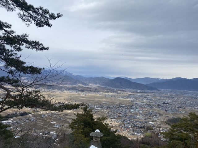
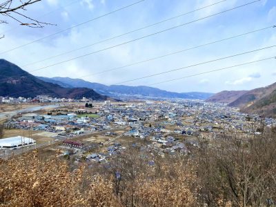
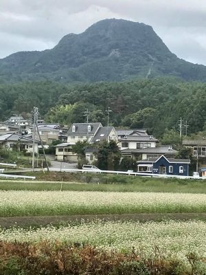
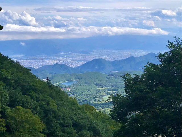
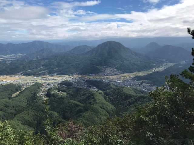
青木村を見下ろす Look down over Aoki Village

Don't pick the mushrooms

とっとろのキノコ? Tottoro's mushroom?

赤色=毒? Red warning of poison?

毒で言えばトリカブト Speaking of poison: munkshood

スタミナランチ: 道の駅「あおき」で馬肉うどん(背景にこまゆ峯) Power lunch at the Aoki Road Station. Horse meat udon. Note Komayu-Mine in the distance

下りてアイス(青木村郷土美術館の喫茶店) Descend for ice cream (Aoki Village Art Museum)'s cafe)

汗を洗って(沓掛温泉・小倉乃湯) Post-hike soak: Ogura no Yu in Kutsukake Onsen

[mappress mapid="6"]


お勧めの登山: 神秘(ときつい)飯縄山 Recommended Hikes: Mystical (and Strenuous) Iizuna Mtn.

2020.09.15: 信州の山 Nagano’s Mountains

亀清旅館の周りは山々で恵まれています。忙しい日々から離れて山登りをするのが人気です。沢山のお客さんがやはりハイキングブーツでお越しになります。私どもも登山が大好きで、お勧めのコースを紹介します。

長野市の里山、1917mの飯縄山が信仰の山で、山頂の神社で戦勝の神でもある飯縄大明神を祀り、武田信玄や上杉謙信が集まった。天狗の伝説もあり、登山道に十三佛の仏像があります。善光寺平を聳え立って北信五岳の一つである飯綱山はこの戸倉上山田温泉からも見える。

私達は9月中旬の平日、天気は晴れのち曇り、その朝のお客さんの見送りしてから行ったわけで、午後1時ごろから登った。最近は東北信の色んな山(飯縄山より高いのも)を登ってますが、登山口から頂上までの標高差は飯縄山の約700mが一番大きい。一の鳥居からの距離が約2.5㎞と言う事は、勾配がかなりきつい。往復4時間の目安で、私達は約3時間だったからもっとのんびり登ったら周りの景色をもっと楽しめたかもしれない。それにしても展望スポット毎に飯綱高原を見下ろしたり、善光寺平を見渡ったりするのは気持ち良かった。頂上に着いたら切りだったから何も見えなかったけど、晴れている日は北アルプスが絶景だそうです。

下記にて写真で紹介します。

Kamesei Ryokan is located in Nagano Prefecture, and we are blessed with being surrounded by mountains and hills, making our area a paradise for mountain climbing and hiking.  Many of our guests escape civilization by heading to the alpine heavens, and show up at our inn wearing hiking boots.  We love exploring the mountains, too, and would like to showcase some of our favorite courses.

Nagano City's hometown mountain is Iizuna-yama.  The 1917 meter-tall peak towers over the city.  It is one of the 5 Major Peaks of Northern Nagano Prefecture.  The shrine at the top honors the Shinto god of victory in battle, and hence was revered by warlords of the Sengokujidai (Warring States Era), like Takeda Shingen and Uesugi Kenshin.  There are fables of a Tengu (goblin) living on the mountain, and the main course is dotted with 13 Buddhist stone figures related to 13 stages in the afterlife.  Iizuna Mountain looms large, both mystically and physically (it is even visible from our onsen town Togura-Kamiyamada).

The day we climbed it was a mid-September weekday and the weather was partly cloudy.  We started after lunch, and only came across a handful of other climbers.  Lately we have been climbing several area peaks, some even taller than Mt. Iizuna.  However, this was the most strenuous climb we've done so far, with over 700 meters in elevation gain in a distance of around 2.5km.  Guide books say to plan on 4 hours round trip -- we did it in just over 3 hours.  Perhaps we could have enjoyed the scenery more if we had climbed at a more leisurely pace.  But the peaks we did have looking down on the plateau down below and the Zenkoji Plain in the distance were certainly gratifying.  By the time we reached the summit it was encased in fog, but on a clear day the views of the Northern Alps are supposedly spectacular.

Following are pictures of our climb.

一の鳥居 Entrance Torii Gate

十三佛の石仏 One of the 13 stone Buddhist statues

十三佛の仏像が点々していて、神秘的な雰囲気。登山道は写真の通り、かなりな勾配。足元を注意しながら登る。One of the 13 stone statues lining the path and lending the course a spiritual feel.  As you can tell from the picture, the trail is quite steep.

駒つなぎの場 と 馬頭観音 Foal Tethering Clearing and Horse Memorial

コースの半分点で馬に関わっている不思議な広場。馬は山のここまで登れる?! Around the half-way point is a small clearing with horse-related memorials, curious as it's inconceivable horses could make the climb to this stage.

水場 Water spring

飯綱高原を見下ろす Looking down on the plateau below

Tengu Rock

大きい岩で、表面の真ん中が少し凹んでいて、習字の硯みたい。しかしい、天狗は書道をやるのかい? Large rock with a natural depression in the surface, like the rubbing stone used in calligraphy.  I can see the size resembling something a tengu goblin would use, but as far as I know, tengu don't practice calligraphy...

戸隠川の登山口との分かれ道 Joining with the trail from the Togakushi side

飯縄神社 Iizuna Shrine

頂上から善光寺平を見下ろす眺めThe view from the summit looking out over the Zenkoji Plain

Crossing the saddle to the actual summit 鞍を渡って本山頂へ

Iizuna Mtn. Summit, 1917 meters

切りがかかった下り Foggy Descent

飯縄山の名前の由来は下に暮らしていた人々の飢饉時に天狗が山から採れた飯を持って行ったと言われた。「飯砂」と言っていて、それが飯綱に変わった。Legend has it that during a famine, the Tengu brought lichen as food for the people below, from which the name "Iizuna" originates.

アクセス

車で、亀清から善光寺経由で「バードライン」で大座法師池を越えて、一の鳥居苑地まで、36㎞、約60分。 交通機関は戸倉駅から長野駅まで(25分)+Alpicoの戸隠へのバス、「飯縄山登山口」下車(47分) 注:実際の登山口は一の鳥居苑地・バス停から別荘地を1㎞(約15分)歩きで、そこにも狭い駐車場はあるけど、一の鳥居苑地でトイレもあるし、お勧めです。

注意点

最後の四分の一は木影がないので、帽子と日焼き止めを。トイレは一の鳥居苑地のみ。携帯トイレを買えるし頂上近くにそれを利用できる小屋があるが… 水は水場が途中にあるけど、特に夏に十分持つように。登山口はこの一の鳥居からにしましたが、戸隠側(ちびっこ忍者村近辺)にもある。標高が少し高いけど、距離があるので登る時間はほぼ一緒。

立ち寄り湯

飯縄山の天狗伝説を考えると、近くの牟礼温泉「天狗の館」がお勧め。

ACCESS

By car, from Kamesei Ryokan drive to Zenkoji Temple in central Nagano City then take the "Bird Line" highway up Iizuna, past Daizahoshi Pond to the Ichi-no-Torii Park; 36km, approx. 60 min.  By public transport, take the train to Nagano Station (25 minutes from Togura), then Alpico's Togakushi Bus to the Iizuna Tozanguchi stop (47 min.).   Note that the actual trailhead is a 15 minute / 1 km walk through a neighborhood peppered with summer homes.  There is limited parking there, but the Ichi-no-Torii Park / bus stop area is recommended as there is a toilet.

CLIMBING NOTES

The last quarter of the hike has little shade, so be sure to take a hat and sun lotion.  The only toilet is at the above-mentioned park.  You can buy a disposable potty bag, and there is a privacy shed near the summit for using one, but the public toilet is much more ... civilized.  There is a water spring half-way up the mountain, but be sure to take lots of water.  I drank 2 liters, and it was a relatively cool day.  The trail is also popular in the winter, although I can't fathom how the trail would be with snow.  It's also supposedly popular with children as young as 5 or 6, but I'm sure the pace would have to be slower to accommodate them.  We climbed from the Ichi-no-Torii trailhead, but another option would be to start from the Togakushi side near the Kids Ninja Village.  The trail is longer, but starts at a higher elevation and takes around the same time.  For a post-hike onsen, with the mountain's Tengu theme, I would suggest Tengu-no-Yakata down in nearby Mure


[mappress mapid="5"][mappress mapid="null"]