お勧めの登山: 絶景里山の子檀嶺 Recommended Hikes: Panoramic Backyard-Mountain Komayumine

2020.09.25: 信州の山 Nagano’s Mountains

また亀清旅館の近くの登山スポットを紹介します: 上田市の隣の青木村の子檀嶺(こまゆみね)。青木村を代表できる里山は高さ1223mで、登山道は特に後半が結構な勾配でかなり良い汗をかけますが、頂上に着く突端に青木村と背景の上田市・塩田平の眺めは素晴らしい。登山道実態は様々の環境(竹林そして杉、松、最後は落葉の森)を通って、飽きない風景。うちは9月下旬で登ったので、彩りのキノコ季節でしたが、山がそんなに高くないから恐らく一年中登れる。地元の学生が1月1日の日ノ出を見に登るそうです。

山のデーター

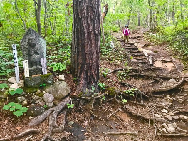
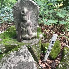
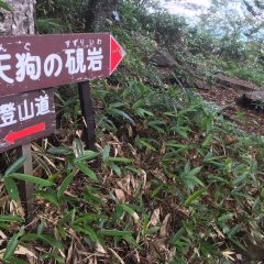
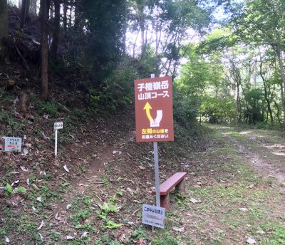
登山道は二つがある: 当郷と田沢温泉。田沢からのコースは少し短いが勾配がより激しいそうです。当郷登山口は亀清から20㎞、車で約35分。下の駐車所にトイレがあり。(馬頭観音のある上の駐車場は3~4台。)

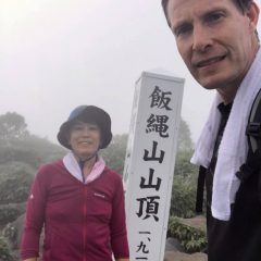
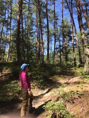
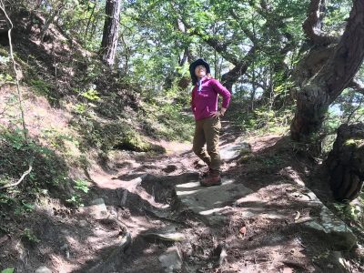
登山道は当郷口から距離が2.86㎞、標高差が542m。登るのは休憩しながら100~120分がかかるそうで、私達は休まないで70分で頂上に辿り着いた。(下りは50分。)登ったのは台風前の晴れた日で、気温が25℃ぐらい。道はずっと木影で、太陽は気にしなかった。

登前のスタミナランチ: 道の駅「あおき」で当地の名物の馬肉うどん。近くの大法寺の三重塔(国宝)の時代で青木村が盛んでいて、馬の売買はその一部だったので、未だに馬肉が好まれている。

下りた後のアイス: 大法寺に隣接している青木村郷土美術館の喫茶店にて、青木産のジェラート。(ついでに、「見返りの塔」と言われている国宝と、時間と心の余裕があれば美術館の展示も是非に。

下りた後の立ち寄り湯: 田沢温泉コースなら当然、田沢温泉。私たちは何回か既に言っているので、今回は青木村のもう一つの温泉地、沓掛に。

台風の予報だったせいか、もう一人としか行き会わなかったという静かなハイクでした。困難な場所は特にないので、元気な小学生は踏ん張りしたら登れる。

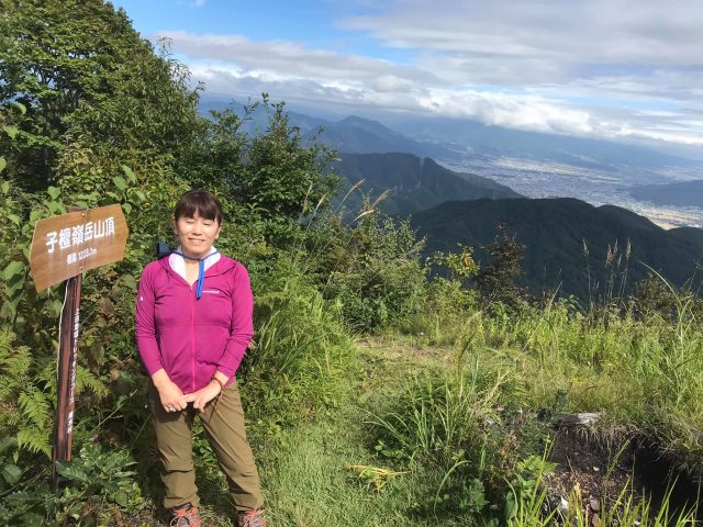
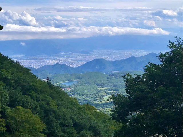
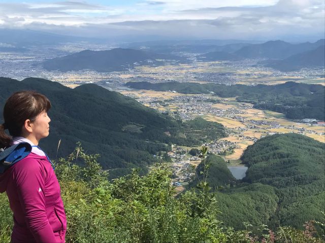
こまゆ峯の頂上からの絶景 Panoramic view from Komayumine summit

Another in our series of local hiking spots:  Komayu-Mine Mtn. in nearby Aoki Village.  It's one of the village's most well-loved "sato-yama" (like a backyard mountain).    The trail gets pretty steep especially towards the end, but the panoramic view from the top is worth it.  The summit overlooks the village down below as well as Ueda City's Shioda Plain in the distance.  The trail itself traverses a wide variety of scenery, starting with a bamboo thicket, then a cedar forest, followed by some gnarly Japanese pines before the deciduous forest on the upper half.  It's a delight for the eyes and senses, especially if you go in late September or October as we did, when a plethora of colorful mushrooms will greet you.  As the peak is a relatively low 1223 meters, it is climbable pretty much year-round.  In fact, the local school children make an ascent every year on January 1st to see the New Years sunrise.

Trail Info:  There are 2 courses, one starts from the Togo district and the other from near Tazawa Onsen.  We climbed the Togo Trail which is 2.86km long and rises in altitude 542 meters.  With rest stops, it supposedly takes 100~120 minutes.  We powered through and climbed it in 70 minutes.  (The descent took us 50 minutes.)  We picked a late-September day just before a typhoon was to hit, so the temperature was a pleasant 25 deg C.  The Togo trailhead has 2 parking lots, the lower one with a public toilet, and the upper, smaller one with a horse memorial.  It is 20km from Kamesei, approx. 35 minutes by car.  By public transport, you can take the bus bound for Aoki from Ueda Station and get off at the Togo (当郷) stop, 25 min.

Pre-Climb Lunch Spot:  The Aoki Michi no Eki (Road Station) has a cafeteria that serves the local specialty, baniku (horse meat) udon.  It's a hearty stew with thick udon noodles and the area's trademark horse meat.   The nearby Daihouji Temple features a 3-story pagoda that is a designated national treasure.  Back in the 14th century when it was constructed, Aoki Village was a stop-over on trade routes and prospered with horse trading, hence the popularity of horse meat even today.

Post-Climb Ice Cream:  The art museum adjacent to Daihouji Temple has a cafe that offers made-in-Aoki gelato.   Make sure to check out the famous pagoda, and see if the stories about it being so mesmerizing that you keep looking back at it as you leave, are true.  And, if you have the time (and the heart), see what the museum has on display.

Post-Climb Onsen:  If climbing from the Tazawa side, then, of course, Tazawa Onsen.  Since we'd been to Tazawa numerous times, we decided to check out Aoki Village's other onsen district:  Kutsukake and it's public bath, Ogura no Yu.

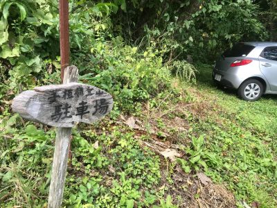
馬頭観音のある小さい駐車場 Small parking lot with the horse memorial

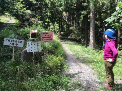
当郷の登山口 Togo Trailhead

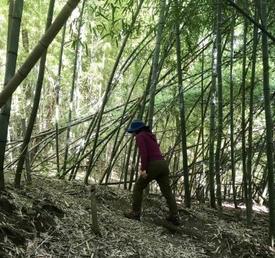
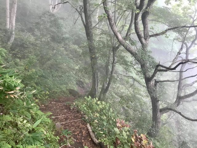
最初は竹林 Bamboo thicket at the start

過ぎの森を通って Pass through a cedar forest

老松を通って Then past some gnarly Japanese pine trees

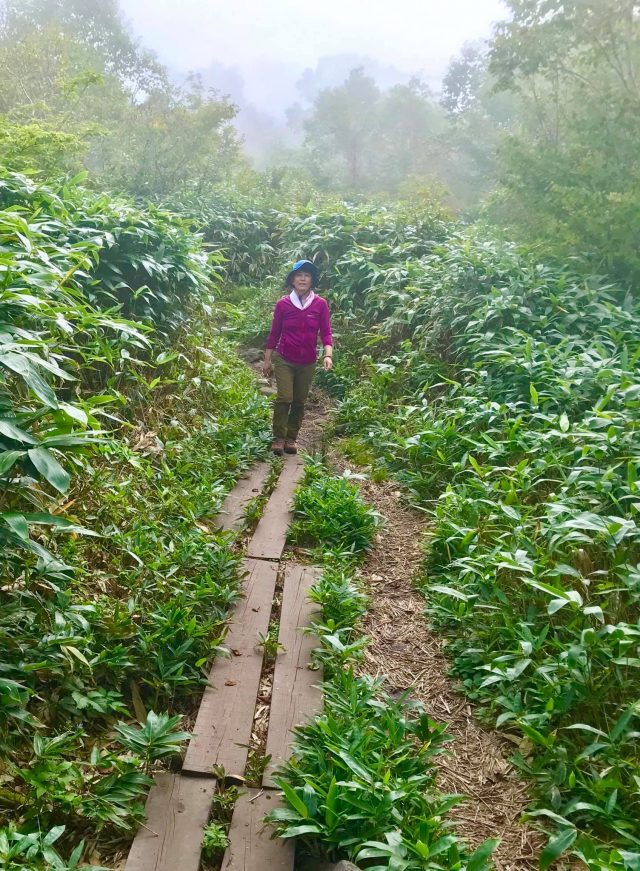
緩やかな林道から勾配のきつい後半の登山道 The trail levels out joining a logging road before splitting off to start the steeper 2nd half

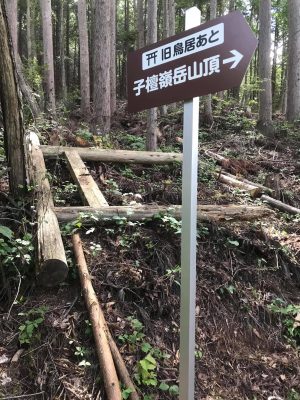
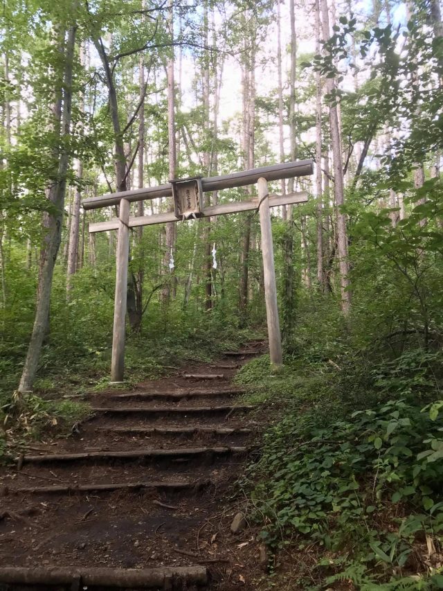
倒れた鳥居を横切って Pass the fallen torii gate

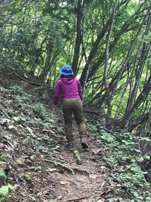
落針の森の中で踏ん張る Huff and puff up through a deciduous forest

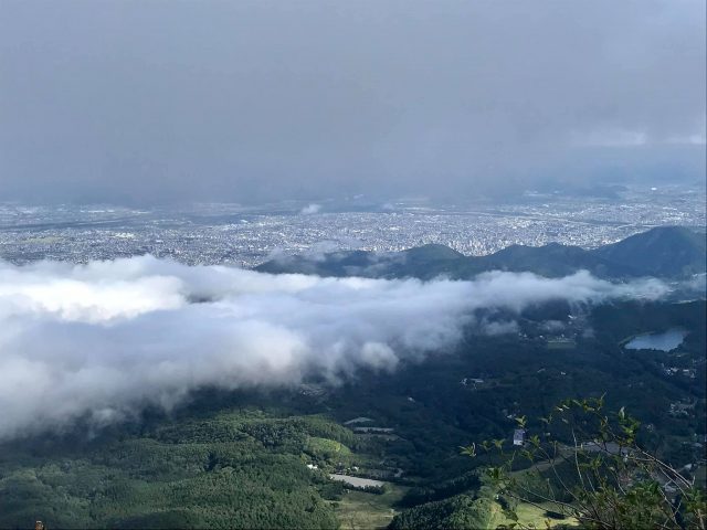
登山価値のある頂上からの眺め The view from the summit is worth the sweat!

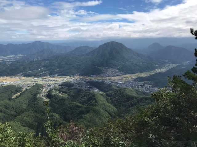
青木村を見下ろす Look down over Aoki Village

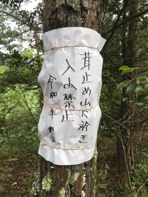
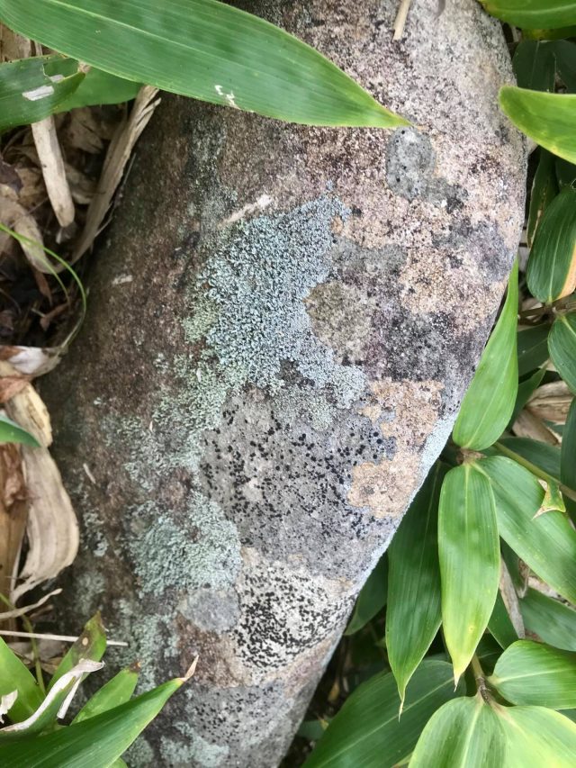
Don't pick the mushrooms

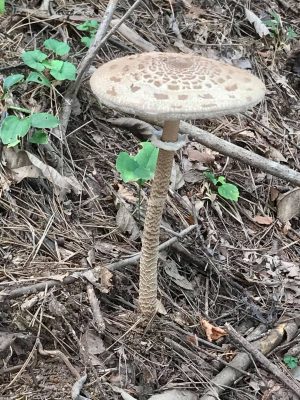
とっとろのキノコ? Tottoro's mushroom?

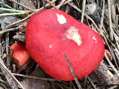
赤色=毒? Red warning of poison?

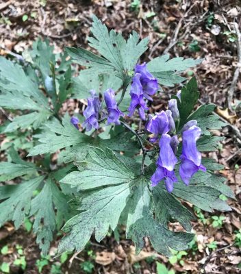
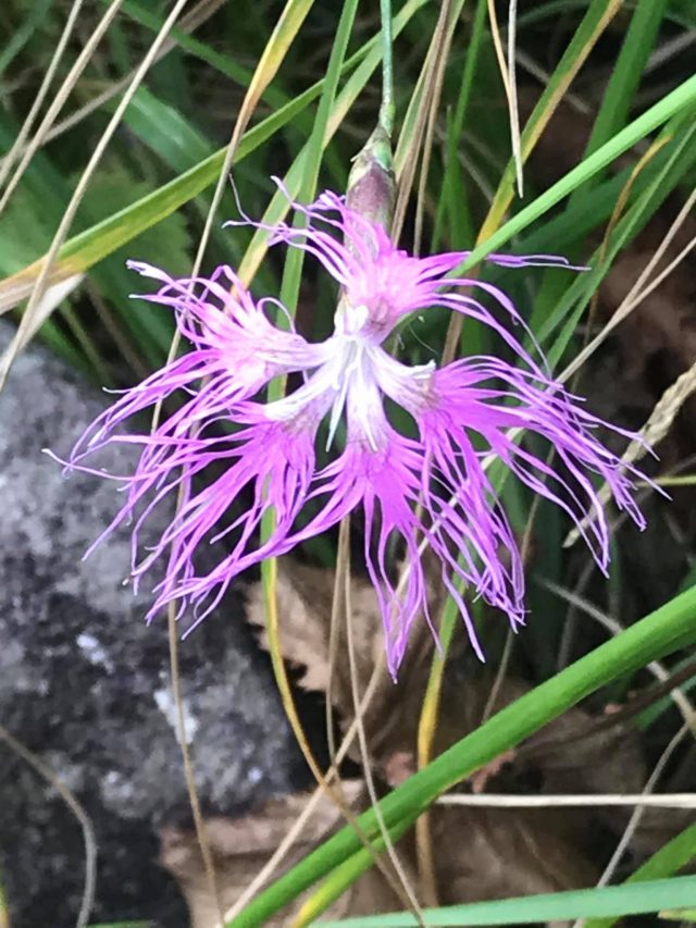
毒で言えばトリカブト Speaking of poison: munkshood

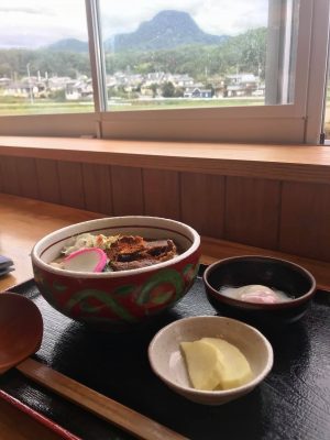
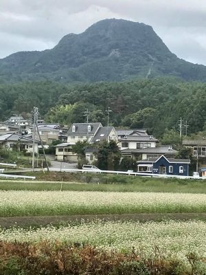
スタミナランチ: 道の駅「あおき」で馬肉うどん(背景にこまゆ峯) Power lunch at the Aoki Road Station. Horse meat udon. Note Komayu-Mine in the distance

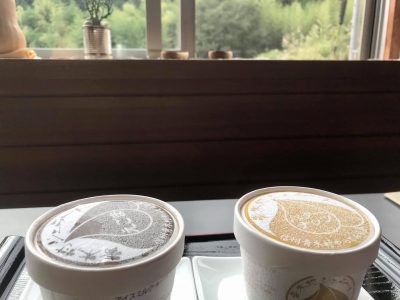
下りてアイス(青木村郷土美術館の喫茶店) Descend for ice cream (Aoki Village Art Museum)'s cafe)

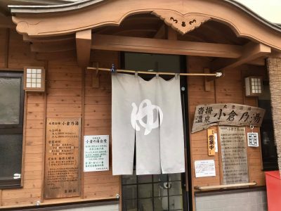
汗を洗って(沓掛温泉・小倉乃湯) Post-hike soak: Ogura no Yu in Kutsukake Onsen

[mappress mapid="6"]


お勧めの登山: 神秘(ときつい)飯縄山 Recommended Hikes: Mystical (and Strenuous) Iizuna Mtn.

2020.09.15: 信州の山 Nagano’s Mountains

亀清旅館の周りは山々で恵まれています。忙しい日々から離れて山登りをするのが人気です。沢山のお客さんがやはりハイキングブーツでお越しになります。私どもも登山が大好きで、お勧めのコースを紹介します。

長野市の里山、1917mの飯縄山が信仰の山で、山頂の神社で戦勝の神でもある飯縄大明神を祀り、武田信玄や上杉謙信が集まった。天狗の伝説もあり、登山道に十三佛の仏像があります。善光寺平を聳え立って北信五岳の一つである飯綱山はこの戸倉上山田温泉からも見える。

私達は9月中旬の平日、天気は晴れのち曇り、その朝のお客さんの見送りしてから行ったわけで、午後1時ごろから登った。最近は東北信の色んな山(飯縄山より高いのも)を登ってますが、登山口から頂上までの標高差は飯縄山の約700mが一番大きい。一の鳥居からの距離が約2.5㎞と言う事は、勾配がかなりきつい。往復4時間の目安で、私達は約3時間だったからもっとのんびり登ったら周りの景色をもっと楽しめたかもしれない。それにしても展望スポット毎に飯綱高原を見下ろしたり、善光寺平を見渡ったりするのは気持ち良かった。頂上に着いたら切りだったから何も見えなかったけど、晴れている日は北アルプスが絶景だそうです。

下記にて写真で紹介します。

Kamesei Ryokan is located in Nagano Prefecture, and we are blessed with being surrounded by mountains and hills, making our area a paradise for mountain climbing and hiking.  Many of our guests escape civilization by heading to the alpine heavens, and show up at our inn wearing hiking boots.  We love exploring the mountains, too, and would like to showcase some of our favorite courses.

Nagano City's hometown mountain is Iizuna-yama.  The 1917 meter-tall peak towers over the city.  It is one of the 5 Major Peaks of Northern Nagano Prefecture.  The shrine at the top honors the Shinto god of victory in battle, and hence was revered by warlords of the Sengokujidai (Warring States Era), like Takeda Shingen and Uesugi Kenshin.  There are fables of a Tengu (goblin) living on the mountain, and the main course is dotted with 13 Buddhist stone figures related to 13 stages in the afterlife.  Iizuna Mountain looms large, both mystically and physically (it is even visible from our onsen town Togura-Kamiyamada).

The day we climbed it was a mid-September weekday and the weather was partly cloudy.  We started after lunch, and only came across a handful of other climbers.  Lately we have been climbing several area peaks, some even taller than Mt. Iizuna.  However, this was the most strenuous climb we've done so far, with over 700 meters in elevation gain in a distance of around 2.5km.  Guide books say to plan on 4 hours round trip -- we did it in just over 3 hours.  Perhaps we could have enjoyed the scenery more if we had climbed at a more leisurely pace.  But the peaks we did have looking down on the plateau down below and the Zenkoji Plain in the distance were certainly gratifying.  By the time we reached the summit it was encased in fog, but on a clear day the views of the Northern Alps are supposedly spectacular.

Following are pictures of our climb.

一の鳥居 Entrance Torii Gate

十三佛の石仏 One of the 13 stone Buddhist statues

十三佛の仏像が点々していて、神秘的な雰囲気。登山道は写真の通り、かなりな勾配。足元を注意しながら登る。One of the 13 stone statues lining the path and lending the course a spiritual feel.  As you can tell from the picture, the trail is quite steep.

駒つなぎの場 と 馬頭観音 Foal Tethering Clearing and Horse Memorial

コースの半分点で馬に関わっている不思議な広場。馬は山のここまで登れる?! Around the half-way point is a small clearing with horse-related memorials, curious as it's inconceivable horses could make the climb to this stage.

水場 Water spring

飯綱高原を見下ろす Looking down on the plateau below

Tengu Rock

大きい岩で、表面の真ん中が少し凹んでいて、習字の硯みたい。しかしい、天狗は書道をやるのかい? Large rock with a natural depression in the surface, like the rubbing stone used in calligraphy.  I can see the size resembling something a tengu goblin would use, but as far as I know, tengu don't practice calligraphy...

戸隠川の登山口との分かれ道 Joining with the trail from the Togakushi side

飯縄神社 Iizuna Shrine

頂上から善光寺平を見下ろす眺めThe view from the summit looking out over the Zenkoji Plain

Crossing the saddle to the actual summit 鞍を渡って本山頂へ

Iizuna Mtn. Summit, 1917 meters

切りがかかった下り Foggy Descent

飯縄山の名前の由来は下に暮らしていた人々の飢饉時に天狗が山から採れた飯を持って行ったと言われた。「飯砂」と言っていて、それが飯綱に変わった。Legend has it that during a famine, the Tengu brought lichen as food for the people below, from which the name "Iizuna" originates.

アクセス

車で、亀清から善光寺経由で「バードライン」で大座法師池を越えて、一の鳥居苑地まで、36㎞、約60分。 交通機関は戸倉駅から長野駅まで(25分)+Alpicoの戸隠へのバス、「飯縄山登山口」下車(47分) 注:実際の登山口は一の鳥居苑地・バス停から別荘地を1㎞(約15分)歩きで、そこにも狭い駐車場はあるけど、一の鳥居苑地でトイレもあるし、お勧めです。

注意点

最後の四分の一は木影がないので、帽子と日焼き止めを。トイレは一の鳥居苑地のみ。携帯トイレを買えるし頂上近くにそれを利用できる小屋があるが… 水は水場が途中にあるけど、特に夏に十分持つように。登山口はこの一の鳥居からにしましたが、戸隠側(ちびっこ忍者村近辺)にもある。標高が少し高いけど、距離があるので登る時間はほぼ一緒。

立ち寄り湯

飯縄山の天狗伝説を考えると、近くの牟礼温泉「天狗の館」がお勧め。

ACCESS

By car, from Kamesei Ryokan drive to Zenkoji Temple in central Nagano City then take the "Bird Line" highway up Iizuna, past Daizahoshi Pond to the Ichi-no-Torii Park; 36km, approx. 60 min.  By public transport, take the train to Nagano Station (25 minutes from Togura), then Alpico's Togakushi Bus to the Iizuna Tozanguchi stop (47 min.).   Note that the actual trailhead is a 15 minute / 1 km walk through a neighborhood peppered with summer homes.  There is limited parking there, but the Ichi-no-Torii Park / bus stop area is recommended as there is a toilet.

CLIMBING NOTES

The last quarter of the hike has little shade, so be sure to take a hat and sun lotion.  The only toilet is at the above-mentioned park.  You can buy a disposable potty bag, and there is a privacy shed near the summit for using one, but the public toilet is much more ... civilized.  There is a water spring half-way up the mountain, but be sure to take lots of water.  I drank 2 liters, and it was a relatively cool day.  The trail is also popular in the winter, although I can't fathom how the trail would be with snow.  It's also supposedly popular with children as young as 5 or 6, but I'm sure the pace would have to be slower to accommodate them.  We climbed from the Ichi-no-Torii trailhead, but another option would be to start from the Togakushi side near the Kids Ninja Village.  The trail is longer, but starts at a higher elevation and takes around the same time.  For a post-hike onsen, with the mountain's Tengu theme, I would suggest Tengu-no-Yakata down in nearby Mure


[mappress mapid="5"][mappress mapid="null"]


Interview with Kamesei's Tyler Lynch on the Japanofiles Podcast

2020.09.03: 亀清旅館 Kamesei Ryokan, メディア Media

Dave Carlson recently interviewed Kamesei Ryokan's proprietor, Tyler Lynch, for his Japanofiles podcast.  This is Tyler's 2nd appearance.  Get caught up on Tyler's various projects with our inn, our onsen town Togura-Kamiyamada, and with inbound tourism for Nagano Prefecture.    Special thanks to Dave-san for the interview, and for talented editing.  Dave-san's Japanofiles podcast is a fantastic way to gain insight into the international community in and around Matsumoto.

亀清旅館のオーナー、タイラーが松本のデーブ・カールソンさんのJapanofilesポッドキャストで紹介されました。

Direct Download:

https://japanofiles.com/episode-74

iTunes:

https://podcasts.apple.com/us/podcast/the-japanofiles-podcast/id331131569

Stitcher:

https://www.stitcher.com/podcast/the-japanofiles-podcast-2/the-japanofiles-podcast